জালালাবাদ: সংশোধিত সংস্করণের মধ্যে পার্থক্য
বিষয়বস্তু বিয়োগ হয়েছে বিষয়বস্তু যোগ হয়েছে
সম্পাদনা সারাংশ নেই |
সম্পাদনা সারাংশ নেই |
||
| ২ নং লাইন: | ২ নং লাইন: | ||
<!--See the Table at Infobox settlement for all fields and descriptions of usage--> |
<!--See the Table at Infobox settlement for all fields and descriptions of usage--> |
||
<!-- Basic info ----------------> |
<!-- Basic info ----------------> |
||
| official_name = Jalalabad |
| official_name = জালালাবাদ <br> Jalalabad |
||
| other_name = |
| other_name = আদিনাপুর |
||
| settlement_type = <!--For Town or Village (Leave blank for the default City)--> |
| settlement_type = <!--For Town or Village (Leave blank for the default City)--> |
||
<!-- images and maps -----------> |
<!-- images and maps -----------> |
||
| ১৫ নং লাইন: | ১৫ নং লাইন: | ||
|photo4b = Jalalabad2007.JPG{{!}}Building on a main road |
|photo4b = Jalalabad2007.JPG{{!}}Building on a main road |
||
|size = 300|border = 0|color = Gray}} |
|size = 300|border = 0|color = Gray}} |
||
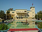
| image_caption = চিত্রটিতে শহরটির গুরুত্বপূর্ণ অংশ তুলে ধরা হয়েছে |
|||
| image_caption = From top left to right: A panoramic view of a section of Jalalabad; Jalalabad Bridge; Jalalabad Cricket Stadium; Pashtunistan Square; Mosque in Jalalabad; Governor's House in Jalalabad; Building on a main road. |
|||
| image_flag = |
| image_flag = |
||
| image_seal = |
| image_seal = |
||
| ২৩ নং লাইন: | ২৩ নং লাইন: | ||
| image_map = |
| image_map = |
||
| map_caption = |
| map_caption = |
||
| pushpin_map = |
| pushpin_map = আফগানিস্তান<!-- the name of a location map as per http://en.wikipedia.org/wiki/Template:Location_map --> |
||
| pushpin_label_position = bottom |
| pushpin_label_position = bottom |
||
| pushpin_mapsize = 300px |
| pushpin_mapsize = 300px |
||
| pushpin_map_caption = |
| pushpin_map_caption = আফগানিস্তানে অবস্থান |
||
| coordinates = {{coord|34|26|03|N|70|26|52|E|region:AF|display=inline,title}} |
| coordinates = {{coord|34|26|03|N|70|26|52|E|region:AF|display=inline,title}} |
||
| subdivision_type = |
| subdivision_type = দেশ |
||
| subdivision_name = [[ |
| subdivision_name = [[আফগানিস্তান]] |
||
| subdivision_type1 = [[Provinces of Afghanistan| |
| subdivision_type1 = [[Provinces of Afghanistan|প্রদেশ]] |
||
| subdivision_name1 = [[ |
| subdivision_name1 = [[নঙ্গারহার প্রদেশ]] |
||
| subdivision_type2 = |
| subdivision_type2 = জেলা |
||
| subdivision_name2 = |
| subdivision_name2 = |
||
| established_title = |
| established_title = প্রতিষ্ঠা |
||
| established_date = |
| established_date = ১৫৭০ |
||
| government_type = |
| government_type = |
||
<!-- Politics -----------------> |
<!-- Politics -----------------> |
||
| government_footnotes = |
| government_footnotes = |
||
| leader_title = |
| leader_title = মেয়র |
||
| leader_name = |
| leader_name = |
||
| leader_title1 = for places with, say, both a mayor and a city manager |
| leader_title1 = for places with, say, both a mayor and a city manager |
||
০৮:২৯, ৬ নভেম্বর ২০১৮ তারিখে সংশোধিত সংস্করণ
| জালালাবাদ Jalalabad আদিনাপুর | |
|---|---|
চিত্রটিতে শহরটির গুরুত্বপূর্ণ অংশ তুলে ধরা হয়েছে | |
| আফগানিস্তানে অবস্থান | |
| স্থানাঙ্ক: ৩৪°২৬′০৩″ উত্তর ৭০°২৬′৫২″ পূর্ব / ৩৪.৪৩৪১৭° উত্তর ৭০.৪৪৭৭৮° পূর্ব | |
| দেশ | আফগানিস্তান |
| প্রদেশ | নঙ্গারহার প্রদেশ |
| প্রতিষ্ঠা | ১৫৭০ |
| আয়তন | |
| • স্থলভাগ | ১২২ বর্গকিমি (৪৭ বর্গমাইল) |
| উচ্চতা | ৫৭৫ মিটার (১,৮৮৬ ফুট) |
| জনসংখ্যা (2014) | |
| • শহর | ৩,৫৬,২৭৫ |
| • পৌর এলাকা | ৩,৫৬,২৭৪[১] |
| [২] | |
| সময় অঞ্চল | UTC+4:30 |
| Climate | BWh |
জালালাবাদ /dʒəˈlæləˌbæd/, অথবা ডিজালালাবাদ, পূর্বে ডাকা হত আদিনাপুর পূর্ব আফগানিস্তানের একটি শহর। এটি নঙ্গারহার প্রদেশের রাজধানী। জালালাবাদ মূলত কাবুল নদী এবং কুনার নদী তীরে অবস্থিত। এটি হাইওয়ে দিয়ে আনুমানিক ১৫০-কিলোমিটার (৯৫ মা) পশ্চিমে কাবুলের সাথে সংযুক্ত হয়েছে এবং ১৩০-কিলোমিটার (৮০ মা) হাইওয়ে দিয়ে পূর্ব পাকিস্তানের পেশোয়ার শহর অবস্থিত। ২০১৫ সালের আদমশুমারীর আনুমানিক হিসাব অনুযায়ী জালালাবাদের জনসংখ্যা ছিল প্রায় ৩৫৬,২৭৪ জন এর মত, এটি আফগানিস্তানের পাঁচটি বৃহত্তম শহরগুলির মধ্যে অন্যতম একটি।[৩]
তথ্যসূত্র
- ↑ "The State of Afghan Cities report 2015"। ২০১৫-১০-৩১ তারিখে মূল থেকে আর্কাইভ করা।
- ↑ "MRRD" (পিডিএফ)। ২০১০-০৩-০৪ তারিখে মূল (পিডিএফ) থেকে আর্কাইভ করা। সংগ্রহের তারিখ ২০১৩-০৩-১৩।
- ↑ "The State of Afghan Cities report2015"। ২০১৫-১০-৩১ তারিখে মূল থেকে আর্কাইভ করা।
বহিঃসংযোগ
উইকিমিডিয়া কমন্সে জালালাবাদ সংক্রান্ত মিডিয়া রয়েছে।
- ইউটিউবে গাজী আমানউল্লাহ খান সিটি
- "Jalalabad"। Islamic Cultural Heritage Database। Istanbul: Organization of Islamic Cooperation, Research Centre for Islamic History, Art and Culture। ২০১৩-০৬-১৫ তারিখে মূল থেকে আর্কাইভ করা।


