
চিত্র:Korea demilitarized zone map - 1969.jpg

এই প্রাকদর্শনের আকার: ৮০০ × ২২৫ পিক্সেল। অন্যান্য আকারসমূহ: ৩২০ × ৯০ পিক্সেল | ৬৪০ × ১৮০ পিক্সেল | ১,০২৪ × ২৮৮ পিক্সেল | ১,২৮০ × ৩৬০ পিক্সেল | ২,৫৬০ × ৭২১ পিক্সেল | ১১,৪৫৬ × ৩,২২৬ পিক্সেল।
পূর্ণ রেজোলিউশন (১১,৪৫৬ × ৩,২২৬ পিক্সেল, ফাইলের আকার: ১৩.২৫ মেগাবাইট, এমআইএমই ধরন: image/jpeg)
| এই ফাইলটি উইকিমিডিয়া কমন্স থেকে নেওয়া। সেখানের বর্ণনা পাতার বিস্তারিত নিম্নে দেখানো হলো। (সম্পাদনা)
|
| বিবরণ |
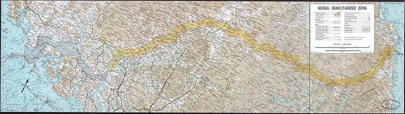
English: A map of the Korean demilitarized zone (DMZ), produced by the CIA in 1969.
|
||||||
| তারিখ | |||||||
| উৎস |
Library of Congress
|
||||||
| লেখক | Central Intelligence Agency | ||||||
| অনুমতি (এ ফাইলের পুনঃব্যবহার) |
|
||||||

ফাইলের ইতিহাস
যেকোনো তারিখ/সময়ে ক্লিক করে দেখুন ফাইলটি তখন কী অবস্থায় ছিল।
| তারিখ/সময় | সংক্ষেপচিত্র | মাত্রা | ব্যবহারকারী | মন্তব্য | |
|---|---|---|---|---|---|
| বর্তমান | ০৬:২৩, ১৬ ফেব্রুয়ারি ২০১০ | ১১,৪৫৬ × ৩,২২৬ (১৩.২৫ মেগাবাইট) | Inductiveload | {{Information |Description={{en|A map of the Korean demilitarized zone (DMZ), produced by the CIA in 1969. :Relief shown by contours and spot heights. Depths shown by contours. :Oriented with north toward the upper right. :Scale 1:250,000.}} |Source=Lib |
সংযোগসমূহ
নিচের পৃষ্ঠা(গুলো) থেকে এই ছবিতে সংযোগ আছে:
ফাইলের বৈশ্বিক ব্যবহার
নিচের অন্যান্য উইকিগুলো এই ফাইলটি ব্যবহার করে:
- az.wikipedia.org-এ ব্যবহার
- bg.wikipedia.org-এ ব্যবহার
- cs.wikipedia.org-এ ব্যবহার
- de.wikipedia.org-এ ব্যবহার
- de.wiktionary.org-এ ব্যবহার
- el.wikipedia.org-এ ব্যবহার
- en.wikipedia.org-এ ব্যবহার
- es.wikipedia.org-এ ব্যবহার
- fr.wikipedia.org-এ ব্যবহার
- hi.wikipedia.org-এ ব্যবহার
- hu.wikipedia.org-এ ব্যবহার
- hy.wikipedia.org-এ ব্যবহার
- it.wikipedia.org-এ ব্যবহার
- ja.wikipedia.org-এ ব্যবহার
- ka.wikipedia.org-এ ব্যবহার
- ku.wikipedia.org-এ ব্যবহার
- ml.wikipedia.org-এ ব্যবহার
- mn.wikipedia.org-এ ব্যবহার
- pnb.wikipedia.org-এ ব্যবহার
- ro.wikipedia.org-এ ব্যবহার
- simple.wikipedia.org-এ ব্যবহার
- ta.wikipedia.org-এ ব্যবহার
- ur.wikipedia.org-এ ব্যবহার
- vi.wikipedia.org-এ ব্যবহার
- zh.wikipedia.org-এ ব্যবহার