
চিত্র:Insurance Plan of City of London Vol. I; sheet 23 (BL 150118).tiff

এই TIF ফাইলের জন্য এই JPG প্রাকদর্শনের আকার: ৫১৩ × ৬০০ পিক্সেল। অন্যান্য আকারসমূহ: ২০৫ × ২৪০ পিক্সেল | ৪১১ × ৪৮০ পিক্সেল | ৬৫৭ × ৭৬৮ পিক্সেল | ৮৭৬ × ১,০২৪ পিক্সেল | ১,৭৫২ × ২,০৪৮ পিক্সেল | ৩,১৫৯ × ৩,৬৯৩ পিক্সেল।
পূর্ণ রেজোলিউশন (৩,১৫৯ × ৩,৬৯৩ পিক্সেল, ফাইলের আকার: ৩৩.৩৮ মেগাবাইট, এমআইএমই ধরন: image/tiff)
| এই ফাইলটি উইকিমিডিয়া কমন্স থেকে নেওয়া। সেখানের বর্ণনা পাতার বিস্তারিত নিম্নে দেখানো হলো। (সম্পাদনা)
|
সারাংশ
লাইসেন্স প্রদান
|
এই কর্মটি এর উৎস দেশে পাবলিক ডোমেইনে রয়েছে এবং অন্যান্য দেশ ও অঞ্চলে যেখানে কপিরাটের সময়সীমা হচ্ছে লেখকের জীবন যোগ ১০০ বছর বা তাঁর কম। এই কাজটি মার্কিন যুক্তরাষ্ট্রে পাবলিক ডোমেইনে রয়েছে কারণ এটি ১ জানুয়ারি, ১৯২৯ সালের আগে প্রকাশিত (অথবা মার্কিন কপিরাইট অফিসে নিবন্ধিত) হয়েছিল। | |
| এই ফাইলটি কপিরাইট আইনের আওতায় জানা সকল বাধানিষেধ মুক্ত বলে চিহ্নিত হয়েছে, যার মধ্যে সম্পর্কিত সকল স্বত্ব ও নেইবারিং সত্ত্ব সংযুক্ত। | |
ফাইলের ইতিহাস
যেকোনো তারিখ/সময়ে ক্লিক করে দেখুন ফাইলটি তখন কী অবস্থায় ছিল।
| তারিখ/সময় | সংক্ষেপচিত্র | মাত্রা | ব্যবহারকারী | মন্তব্য | |
|---|---|---|---|---|---|
| বর্তমান | ১৮:৩৯, ২৪ মার্চ ২০১৭ | 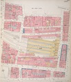 | ৩,১৫৯ × ৩,৬৯৩ (৩৩.৩৮ মেগাবাইট) | Fæ | British Library Fire insurance maps, #313, http://www.bl.uk/onlinegallery/onlineex/firemaps/england/london/itov/mapsu145ubu22u1uf023r.html |
সংযোগসমূহ
নিচের পৃষ্ঠা(গুলো) থেকে এই ছবিতে সংযোগ আছে:
ফাইলের বৈশ্বিক ব্যবহার
নিচের অন্যান্য উইকিগুলো এই ফাইলটি ব্যবহার করে:
- en.wikipedia.org-এ ব্যবহার
- nl.wikipedia.org-এ ব্যবহার
- zh.wikipedia.org-এ ব্যবহার