
চিত্র:ParacelIslands.png
এর চেয়ে বেশি রেজোলিউশন লভ্য নয়।
ParacelIslands.png (৩২৫ × ৩৫০ পিক্সেল, ফাইলের আকার: ৫ কিলোবাইট, এমআইএমই ধরন: image/png)
| এই ফাইলটি উইকিমিডিয়া কমন্স থেকে নেওয়া। সেখানের বর্ণনা পাতার বিস্তারিত নিম্নে দেখানো হলো। (সম্পাদনা)
|

|
This map image could be re-created using vector graphics as an SVG file. This has several advantages; see Commons:Media for cleanup for more information. If an SVG form of this image is available, please upload it and afterwards replace this template with
{{vector version available|new image name}}.
It is recommended to name the SVG file “ParacelIslands.svg”—then the template Vector version available (or Vva) does not need the new image name parameter. |
| বিবরণ |
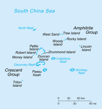
English: Paracel Island map |
| উৎস | Adapted from image from CIA World Factbook |
| লেখক | CIA |
লাইসেন্স প্রদান
এই ছবিটি পাবলিক ডোমেইনে কারণ এটিতে উপকরণ রয়েছে যা মূলত মার্কিন যুক্তরাষ্ট্রের কেন্দ্রীয় গোয়েন্দা সংস্থার ওয়ার্ল্ড ফ্যাক্টবুক থেকে এসেছে।
|
 |
মূল আপলোড লগ
মূল বিবরণ পাতাটি এখানে ছিল। নিম্নলিখিত সকল ব্যবহারকারীর নাম en.wikipedia-এ উল্লেখ করা ছিল।
- 2003-04-23 20:43 Hephaestos 330×355× (14219 bytes) Paracel Island map
ফাইলের ইতিহাস
যেকোনো তারিখ/সময়ে ক্লিক করে দেখুন ফাইলটি তখন কী অবস্থায় ছিল।
| তারিখ/সময় | সংক্ষেপচিত্র | মাত্রা | ব্যবহারকারী | মন্তব্য | |
|---|---|---|---|---|---|
| বর্তমান | ২০:০৭, ৫ মার্চ ২০১৩ | | ৩২৫ × ৩৫০ (৫ কিলোবাইট) | Ras67 | cropped |
| ১০:৩৭, ২ ফেব্রুয়ারি ২০০৯ |  | ৩৩০ × ৩৫৫ (১৪ কিলোবাইট) | File Upload Bot (Magnus Manske) | {{BotMoveToCommons|en.wikipedia}} {{Information |Description={{en|Paracel Island map Source: Adapted from [https://www.cia.gov/library/publications/the-world-factbook/maps/pf-map.gif image] from [https://www.cia.gov/library/publications/the-world-factbo |
সংযোগসমূহ
নিচের পৃষ্ঠা(গুলো) থেকে এই ছবিতে সংযোগ আছে:
ফাইলের বৈশ্বিক ব্যবহার
নিচের অন্যান্য উইকিগুলো এই ফাইলটি ব্যবহার করে:
- ar.wikipedia.org-এ ব্যবহার
- ast.wikipedia.org-এ ব্যবহার
- bg.wikipedia.org-এ ব্যবহার
- br.wikipedia.org-এ ব্যবহার
- ca.wikipedia.org-এ ব্যবহার
- ceb.wikipedia.org-এ ব্যবহার
- cs.wikipedia.org-এ ব্যবহার
- en.wikipedia.org-এ ব্যবহার
- en.wikivoyage.org-এ ব্যবহার
- eo.wikipedia.org-এ ব্যবহার
- es.wikipedia.org-এ ব্যবহার
- eu.wikipedia.org-এ ব্যবহার
- fa.wikipedia.org-এ ব্যবহার
- fr.wikipedia.org-এ ব্যবহার
- he.wikipedia.org-এ ব্যবহার
- ja.wikipedia.org-এ ব্যবহার
এই ফাইলের অন্যান্য বৈশ্বিক ব্যবহার দেখুন।