
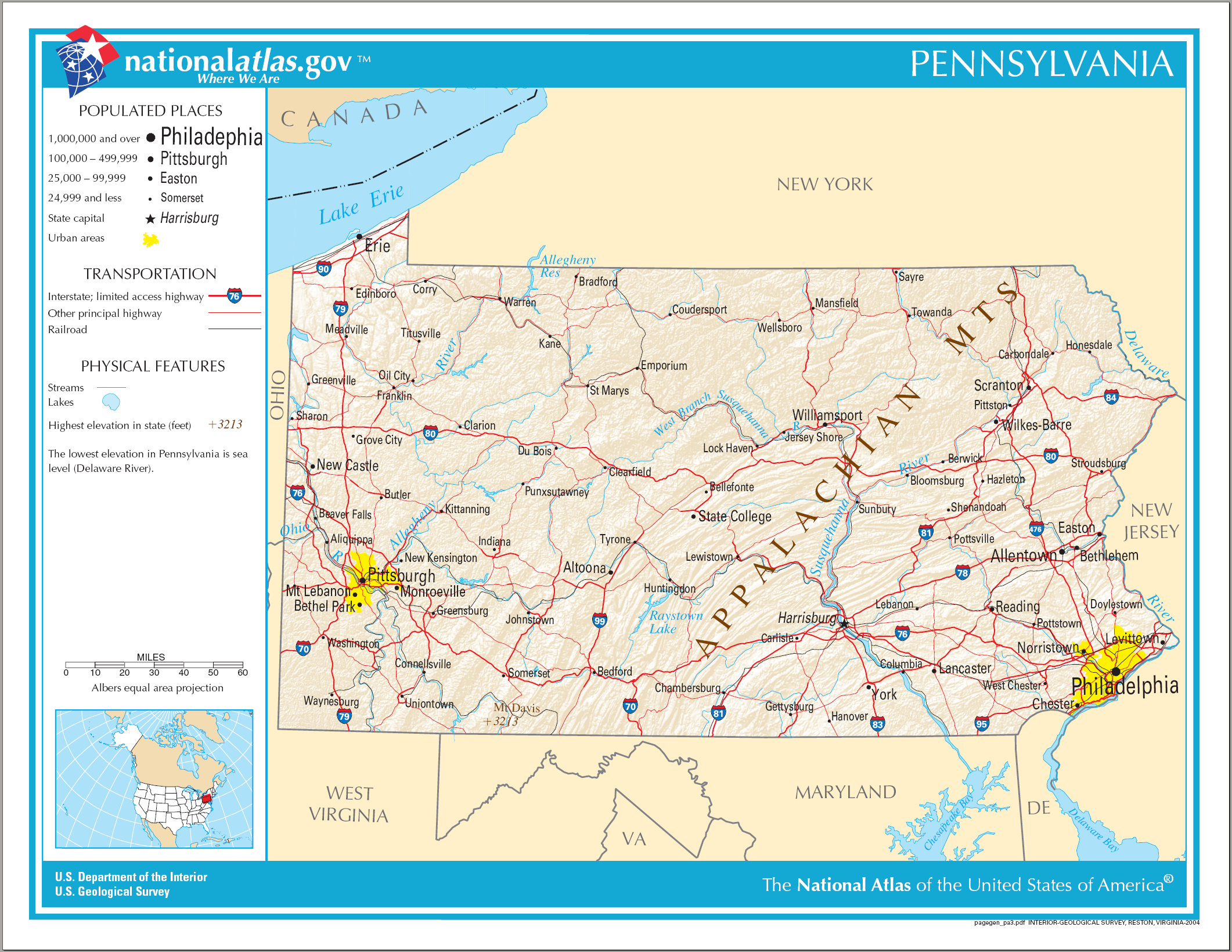
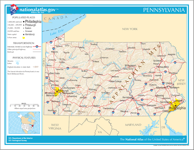
চিত্র:Map of Pennsylvania NA.png
এই প্রাকদর্শনের আকার: ৭৭৬ × ৬০০ পিক্সেল। অন্যান্য আকারসমূহ: ৩১১ × ২৪০ পিক্সেল | ৬২১ × ৪৮০ পিক্সেল | ৯৯৪ × ৭৬৮ পিক্সেল | ১,২৮০ × ৯৮৯ পিক্সেল | ২,১২২ × ১,৬৪০ পিক্সেল।
পূর্ণ রেজোলিউশন (২,১২২ × ১,৬৪০ পিক্সেল, ফাইলের আকার: ২.৫৬ মেগাবাইট, এমআইএমই ধরন: image/png)
| এই ফাইলটি উইকিমিডিয়া কমন্স থেকে নেওয়া। সেখানের বর্ণনা পাতার বিস্তারিত নিম্নে দেখানো হলো। (সম্পাদনা)
|
সারাংশ
| বিবরণ |
English: Map of Pennsylvania. |
| তারিখ | |
| উৎস | National Atlas |
| লেখক |
লাইসেন্স প্রদান
This map was obtained from an edition of the National Atlas of the United States. Like almost all works of the U.S. federal government, works from the National Atlas are in the public domain in the United States.
Online access: NationalAtlas.gov | 1970 print edition: Library of Congress, Perry-Castañeda Library
|
ফাইলের ইতিহাস
যেকোনো তারিখ/সময়ে ক্লিক করে দেখুন ফাইলটি তখন কী অবস্থায় ছিল।
| তারিখ/সময় | সংক্ষেপচিত্র | মাত্রা | ব্যবহারকারী | মন্তব্য | |
|---|---|---|---|---|---|
| বর্তমান | ০৯:৪০, ১৫ আগস্ট ২০০৬ | | ২,১২২ × ১,৬৪০ (২.৫৬ মেগাবাইট) | Huebi~commonswiki | {{Information| |Description=Map of Pennsylvania |Source=[http://www.nationalatlas.gov National Atlas] }} Category:Maps of the United States Category:Maps of Pennsylvania {{PD-USGov-Atlas}} |
সংযোগসমূহ
নিচের পৃষ্ঠা(গুলো) থেকে এই ছবিতে সংযোগ আছে:
ফাইলের বৈশ্বিক ব্যবহার
নিচের অন্যান্য উইকিগুলো এই ফাইলটি ব্যবহার করে:
- als.wikipedia.org-এ ব্যবহার
- ar.wikipedia.org-এ ব্যবহার
- bs.wikipedia.org-এ ব্যবহার
- ca.wikipedia.org-এ ব্যবহার
- de.wikipedia.org-এ ব্যবহার
- en.wikipedia.org-এ ব্যবহার
- fi.wikipedia.org-এ ব্যবহার
- fr.wikipedia.org-এ ব্যবহার
- hi.wikipedia.org-এ ব্যবহার
- hr.wiktionary.org-এ ব্যবহার
- hsb.wikipedia.org-এ ব্যবহার
- hu.wikipedia.org-এ ব্যবহার
- ilo.wikipedia.org-এ ব্যবহার
- incubator.wikimedia.org-এ ব্যবহার
- it.wikipedia.org-এ ব্যবহার
- lt.wikipedia.org-এ ব্যবহার
- ru.wikivoyage.org-এ ব্যবহার
- simple.wikipedia.org-এ ব্যবহার
- si.wikipedia.org-এ ব্যবহার
- sw.wikipedia.org-এ ব্যবহার
- szl.wikipedia.org-এ ব্যবহার
- zea.wikipedia.org-এ ব্যবহার