
চিত্র:Location of Donetsk People's Republic.png

এই প্রাকদর্শনের আকার: ৮০০ × ৫৮৬ পিক্সেল। অন্যান্য আকারসমূহ: ৩২০ × ২৩৪ পিক্সেল | ৬৪০ × ৪৬৯ পিক্সেল | ১,০২৪ × ৭৫০ পিক্সেল | ১,২৮০ × ৯৩৮ পিক্সেল | ১,৬৯৪ × ১,২৪১ পিক্সেল।
পূর্ণ রেজোলিউশন (১,৬৯৪ × ১,২৪১ পিক্সেল, ফাইলের আকার: ৬৯৭ কিলোবাইট, এমআইএমই ধরন: image/png)
| এই ফাইলটি উইকিমিডিয়া কমন্স থেকে নেওয়া। সেখানের বর্ণনা পাতার বিস্তারিত নিম্নে দেখানো হলো। (সম্পাদনা)
|

|
This locator map image could be re-created using vector graphics as an SVG file. This has several advantages; see Commons:Media for cleanup for more information. If an SVG form of this image is available, please upload it and afterwards replace this template with
{{vector version available|new image name}}.
It is recommended to name the SVG file “Location of Donetsk People's Republic.svg”—then the template Vector version available (or Vva) does not need the new image name parameter. |
সারাংশ
| বিবরণ |
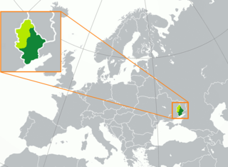
English: territory controlled by the self-proclaimed Donetsk People's Republic (dark green) inside of the Donetsk Oblast (green, light and dark) Русский: Заявленная (светло-зелёный) территория Донецкой Народной Республики, совпадающая с территорией Донецкой области Украины, и контролируемая ДНР территория (тёмно-зелёный) Français : Territoire de la République populaire de Donetsk (vert foncé) dans l'oblast de Donetsk (vert clair) |
| তারিখ | |
| উৎস |
নিজের কাজ |
| লেখক | Oude-rusman |
| অন্যান্য সংস্করণ | এই ফাইলের উপজাত কর্মসমূহ: Location of Donetsk People's Republic (before 2022 invasion).png |
.png)
লাইসেন্স প্রদান
| This map is ineligible for copyright and therefore in the public domain, because it consists entirely of information that is common property and contains no original authorship. For more information, see Commons:Threshold of originality § Maps.
|
ফাইলের ইতিহাস
যেকোনো তারিখ/সময়ে ক্লিক করে দেখুন ফাইলটি তখন কী অবস্থায় ছিল।
| তারিখ/সময় | সংক্ষেপচিত্র | মাত্রা | ব্যবহারকারী | মন্তব্য | |
|---|---|---|---|---|---|
| বর্তমান | ০১:০৩, ২ মে ২০২৪ | | ১,৬৯৪ × ১,২৪১ (৬৯৭ কিলোবাইট) | Mulan11111 | map change in small version |
| ০০:৫৭, ২ মে ২০২৪ |  | ১,৬৯৪ × ১,২৪১ (৬৯৪ কিলোবাইট) | Mulan11111 | Update in Avdiivka + around Bakhmut | |
| ০৩:৩১, ২৩ ফেব্রুয়ারি ২০২৩ |  | ১,৬৯৪ × ১,২৪১ (৯০১ কিলোবাইট) | DinoSoupCanada | Update | |
| ১৯:২৭, ১৩ নভেম্বর ২০২২ |  | ১,৬৯৪ × ১,২৪১ (৭১৩ কিলোবাইট) | DinoSoupCanada | Since the article is repurposed as a disputed subject of Russia, then it's fine to edit again. | |
| ২২:৩৮, ১২ অক্টোবর ২০২২ |  | ১,৬৯৪ × ১,২৪১ (২৬৫ কিলোবাইট) | DinoSoupCanada | DPR doesn't exist after September 30th | |
| ১৯:২৭, ১ অক্টোবর ২০২২ |  | ১,৬৯৪ × ১,২৪১ (২৬৫ কিলোবাইট) | Nahabino | Update per ISW; last update for self-proclaimed DPR state | |
| ২৩:৩৪, ৩০ সেপ্টেম্বর ২০২২ |  | ১,৬৯৪ × ১,২৪১ (২৬৫ কিলোবাইট) | Nahabino | Update per ISW | |
| ২২:৫৩, ২৮ সেপ্টেম্বর ২০২২ |  | ১,৬৯৪ × ১,২৪১ (২৬৬ কিলোবাইট) | Nahabino | Update per ISW | |
| ২৩:০৫, ২৭ সেপ্টেম্বর ২০২২ |  | ১,৬৯৪ × ১,২৪১ (২৬৬ কিলোবাইট) | Nahabino | Update per ISW | |
| ২৩:৩৪, ২৬ সেপ্টেম্বর ২০২২ |  | ১,৬৯৪ × ১,২৪১ (২৬৬ কিলোবাইট) | Nahabino | Update per ISW |
সংযোগসমূহ
এই ফাইল ব্যবহার করে এমন কোনো পাতা নেই।
ফাইলের বৈশ্বিক ব্যবহার
নিচের অন্যান্য উইকিগুলো এই ফাইলটি ব্যবহার করে:
- af.wikipedia.org-এ ব্যবহার
- azb.wikipedia.org-এ ব্যবহার
- be-tarask.wikipedia.org-এ ব্যবহার
- be.wikipedia.org-এ ব্যবহার
- bg.wikipedia.org-এ ব্যবহার
- br.wikipedia.org-এ ব্যবহার
- ckb.wikipedia.org-এ ব্যবহার
- crh.wikipedia.org-এ ব্যবহার
- cs.wikipedia.org-এ ব্যবহার
- cv.wikipedia.org-এ ব্যবহার
- en.wikipedia.org-এ ব্যবহার
- es.wikipedia.org-এ ব্যবহার
- ext.wikipedia.org-এ ব্যবহার
- fa.wikipedia.org-এ ব্যবহার
- fi.wikipedia.org-এ ব্যবহার
- fr.wikipedia.org-এ ব্যবহার
- he.wikipedia.org-এ ব্যবহার
- hu.wikipedia.org-এ ব্যবহার
- id.wikipedia.org-এ ব্যবহার
- ie.wikipedia.org-এ ব্যবহার
- is.wikipedia.org-এ ব্যবহার
- it.wikipedia.org-এ ব্যবহার
- ja.wikipedia.org-এ ব্যবহার
- ka.wikipedia.org-এ ব্যবহার
- ko.wikipedia.org-এ ব্যবহার
- ku.wikipedia.org-এ ব্যবহার
- kv.wikipedia.org-এ ব্যবহার
- lij.wikipedia.org-এ ব্যবহার
- li.wikipedia.org-এ ব্যবহার
- lt.wikipedia.org-এ ব্যবহার
- lv.wikipedia.org-এ ব্যবহার
- mi.wikipedia.org-এ ব্যবহার
- ml.wikipedia.org-এ ব্যবহার
- nl.wikipedia.org-এ ব্যবহার
- no.wikipedia.org-এ ব্যবহার
- pl.wikipedia.org-এ ব্যবহার
- pnb.wikipedia.org-এ ব্যবহার
- ps.wikipedia.org-এ ব্যবহার
- pt.wikipedia.org-এ ব্যবহার
- sah.wikipedia.org-এ ব্যবহার
- scn.wikipedia.org-এ ব্যবহার
- sco.wikipedia.org-এ ব্যবহার
- simple.wikipedia.org-এ ব্যবহার
- sl.wikipedia.org-এ ব্যবহার
- sq.wikipedia.org-এ ব্যবহার
এই ফাইলের অন্যান্য বৈশ্বিক ব্যবহার দেখুন।