
চিত্র:IsraelCVFRmag.jpg

এই প্রাকদর্শনের আকার: ২৭১ × ৬০০ পিক্সেল। অন্যান্য আকারসমূহ: ১০৮ × ২৪০ পিক্সেল | ৪৫২ × ১,০০০ পিক্সেল।
পূর্ণ রেজোলিউশন (৪৫২ × ১,০০০ পিক্সেল, ফাইলের আকার: ১০৬ কিলোবাইট, এমআইএমই ধরন: image/jpeg)
| এই ফাইলটি উইকিমিডিয়া কমন্স থেকে নেওয়া। সেখানের বর্ণনা পাতার বিস্তারিত নিম্নে দেখানো হলো। (সম্পাদনা)
|
| বিবরণ |
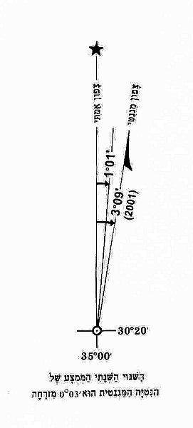
English: Change of magnetic declination in Israel map (Statement for 2001) |
||
| তারিখ | |||
| উৎস | Aeronautical Information Publication - Domestic (AIP) of the Israel Civil Aviation Administration – presently Civil Aviation Authority (CAA) | ||
| লেখক | Etan Tal | ||
| অনুমতি (এ ফাইলের পুনঃব্যবহার) |
|
ফাইলের ইতিহাস
যেকোনো তারিখ/সময়ে ক্লিক করে দেখুন ফাইলটি তখন কী অবস্থায় ছিল।
| তারিখ/সময় | সংক্ষেপচিত্র | মাত্রা | ব্যবহারকারী | মন্তব্য | |
|---|---|---|---|---|---|
| বর্তমান | ১১:৩৪, ৮ অক্টোবর ২০০৯ | | ৪৫২ × ১,০০০ (১০৬ কিলোবাইট) | Etan J. Tal | {{Information |Description={{en|1=Change of magnetic declination in Israel map (Statement for 2001)}} |Source=Aeronautical Information Publication - Domestic (AIP) of the Israel Civil Aviation Administration – presently Civil Aviation Authority (CAA) |A |
সংযোগসমূহ
নিচের পৃষ্ঠা(গুলো) থেকে এই ছবিতে সংযোগ আছে:
ফাইলের বৈশ্বিক ব্যবহার
নিচের অন্যান্য উইকিগুলো এই ফাইলটি ব্যবহার করে:
- en.wikipedia.org-এ ব্যবহার
- he.wikipedia.org-এ ব্যবহার
- it.wikipedia.org-এ ব্যবহার
- ko.wikipedia.org-এ ব্যবহার
- tr.wikipedia.org-এ ব্যবহার