
চিত্র:EB9 Kentucky - geological map.jpg

এই প্রাকদর্শনের আকার: ৮০০ × ৪৫৩ পিক্সেল। অন্যান্য আকারসমূহ: ৩২০ × ১৮১ পিক্সেল | ৬৪০ × ৩৬২ পিক্সেল | ১,২৫৬ × ৭১১ পিক্সেল।
পূর্ণ রেজোলিউশন (১,২৫৬ × ৭১১ পিক্সেল, ফাইলের আকার: ১৯২ কিলোবাইট, এমআইএমই ধরন: image/jpeg)
| এই ফাইলটি উইকিমিডিয়া কমন্স থেকে নেওয়া। সেখানের বর্ণনা পাতার বিস্তারিত নিম্নে দেখানো হলো। (সম্পাদনা)
|
| বিবরণ |
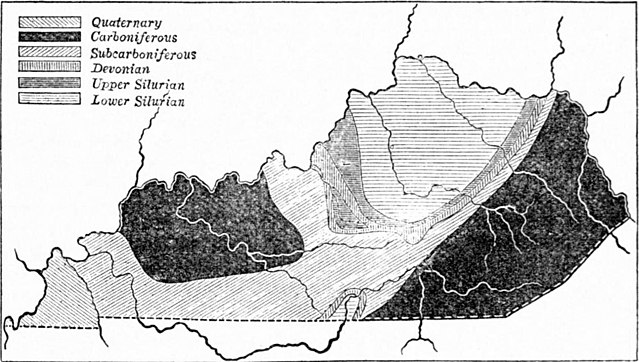
English: Geological map of Kentucky. |
|||
| তারিখ | ||||
| উৎস | "Kentucky" in the Encyclopædia Britannica, Vol. XIV, p. 41. | |||
| লেখক | নামবিহীন, but presumably engraved by John Bartholomew & Son or by William & Alexander Keith Johnston | |||
| অনুমতি (এ ফাইলের পুনঃব্যবহার) |
|

ফাইলের ইতিহাস
যেকোনো তারিখ/সময়ে ক্লিক করে দেখুন ফাইলটি তখন কী অবস্থায় ছিল।
| তারিখ/সময় | সংক্ষেপচিত্র | মাত্রা | ব্যবহারকারী | মন্তব্য | |
|---|---|---|---|---|---|
| বর্তমান | ১৮:২৫, ৩০ জুন ২০১৩ | | ১,২৫৬ × ৭১১ (১৯২ কিলোবাইট) | Bob Burkhardt | {{Information |Description={{en|Geological map of Kentucky.}} |Source=''Encyclopædia Britannica'', v. 14, 1882, p. 41. |Date=published 1882 |Author=not specified; article is by John R. Procter |Permission={{PD-Britannica}} |other_versions= }} [[Catego... |
সংযোগসমূহ
নিচের পৃষ্ঠা(গুলো) থেকে এই ছবিতে সংযোগ আছে:
ফাইলের বৈশ্বিক ব্যবহার
নিচের অন্যান্য উইকিগুলো এই ফাইলটি ব্যবহার করে:
- en.wikisource.org-এ ব্যবহার
- id.wikipedia.org-এ ব্যবহার