এটনা পর্বত
(মাউন্ট এটনা থেকে পুনর্নির্দেশিত)
| মাউন্ট এটনা | |
|---|---|
 মাউন্ট এটনা (দক্ষিণ-পশ্চিম দিক থেকে) | |
| সর্বোচ্চ বিন্দু | |
| উচ্চতা | ৩,৩৫০ মিটার (১০,৯৯০ ফুট) (পরিবর্তনশীল)[১] কোণের প্রস্থ – ৪০ কি.মি. (প্রায়) |
| সুপ্রত্যক্ষতা | ৩,৩২৯.৬ মিটার (১০,৯২৪ ফুট) ৫৯ তম |
| বিচ্ছিন্নতা | ৯৯৮.৭৯ কিমি (৬২০.৬২ মা) |
| তালিকাভুক্তি | সুউচ্চ |
| ভূগোল | |
| অঞ্চল | IT |
| ভূতত্ত্ব | |
| শিলার বয়স | ৫০০,০০০ বছর |
| পর্বতের ধরন | আগ্নেয়গিরি (সংযুক্ত প্রকৃতির) |
| সর্বশেষ অগ্ন্যুত্পাত | ৬ অক্টোবর ২০১২ |
| আরোহণ | |
| সহজ পথ | rock climb |

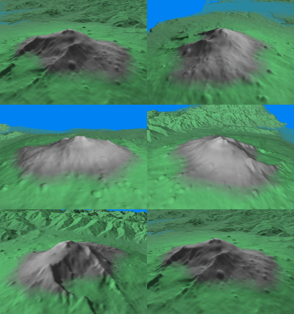
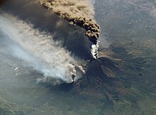
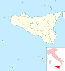
মাউন্ট এটনা (Latin: Aetna) সিসিলি দ্বীপের পূর্ব উপকূলীয় এলাকায় অবস্থিত একটি সক্রিয় আগ্নেয়গিরি। এটি আফ্রিকা প্লেট ও ইউরোশিয়া প্লেটের মধ্যবর্তী স্থানে অবস্থিত। এটি ইউরোপের সর্ব্বোচ্চ সক্রিয় আগ্নেয়গিরি, যা ৩,৩২৯ মি (১০,৯২২ ফু) উচুঁ।
ভূতাত্ত্বিক ইতিহাস[সম্পাদনা]


অগ্ন্যুৎপাদ[সম্পাদনা]
অতি সাম্প্রতিককালে[সম্পাদনা]


অনন্যসাধারণ বৈশিষ্ঠ্য[সম্পাদনা]
১৯৭০ সালে এটনা ধোয়ার কুন্ডলী অগ্ন্যুৎপাত করে,[২] যা এধরনের প্রথম দৃষ্ট হয় এবং এটি অতি দুর্লভ ধরনের। একই ধরনের ঘটনা পুনরায় ঘটে ২০০০ সালে।[৩]
বহি:সংযোগ[সম্পাদনা]
উইকিমিডিয়া কমন্সে এটনা পর্বত সংক্রান্ত মিডিয়া রয়েছে।
- Istituto Nazionale di Geofisica e Vulcanologia, Sezione di Catania - যেখান থেকে পর্যবেক্ষণ করা হয়
- মাউন্ট এটনা-এর ভূতত্ত্ব ও ইতিহাস
- লাইভ ওয়েব ক্যাম-এ
- মাউন্ট এটনা-এর ভূতাত্ত্বিক গঠন
- মাউন্ট এটনা ও মানুষ
তথ্যসূত্র[সম্পাদনা]
- ↑ ক খ The elevation varies with volcanic activity. It is frequently given as ৩,৩৫০ মি (১০,৯৯০ ফু), but many sources that support this concede that it is approximate. The coordinates given, which are consistent with SRTM data, are from a 2005 GPS survey. The elevation data are based on a LIDAR (Light Detection and Ranging) survey carried out in June 2007, see Neri, M.; ও অন্যান্য (২০০৮), "The changing face of Mount Etna's summit area documented with Lidar technology", Geophysical Research Letters, 35: L09305, ডিওআই:10.1029/2008GL033740, বিবকোড:2008GeoRL..3509305N
- ↑ http://www.stromboli.net/etna/etna00/etna0002photovideo-en.html Smoke rings generated by eruptions of Etna volcano
- ↑ "Etna hoops it up"। BBC News। ২০০০-০৩-৩১। সংগ্রহের তারিখ ২০০৮-১০-০৯।

