
চিত্র:Uttarakhand locator map.svg

এই SVG ফাইলের জন্য এই PNG প্রাকদর্শনের আকার: ৬৬৬ × ৫৯৯ পিক্সেল। অন্যান্য আকারসমূহ: ২৬৭ × ২৪০ পিক্সেল | ৫৩৩ × ৪৮০ পিক্সেল | ৮৫৩ × ৭৬৮ পিক্সেল | ১,১৩৮ × ১,০২৪ পিক্সেল | ২,২৭৬ × ২,০৪৮ পিক্সেল | ১,২৫০ × ১,১২৫ পিক্সেল।
পূর্ণ রেজোলিউশন (এসভিজি ফাইল, সাধারণত ১,২৫০ × ১,১২৫ পিক্সেল, ফাইলের আকার: ১৩৭ কিলোবাইট)
| এই ফাইলটি উইকিমিডিয়া কমন্স থেকে নেওয়া। সেখানের বর্ণনা পাতার বিস্তারিত নিম্নে দেখানো হলো। (সম্পাদনা)
|
সারাংশ
| বিবরণ |
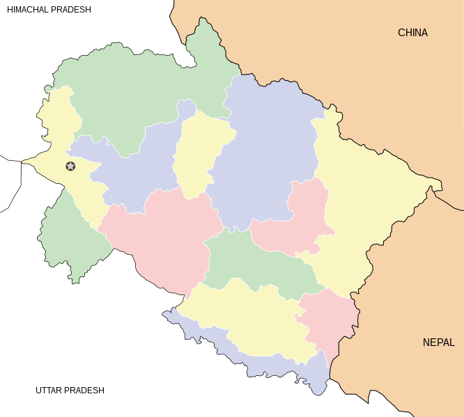
English: Locator map for the state of w:Uttarakhand. Equirectangular projection. Geographic limits of the map: top=31.61, bottom=28.50, left=77.46, right=81.19. |
| তারিখ | |
| উৎস | নিজের কাজ |
| লেখক | Mkeranat |
লাইসেন্স প্রদান
আমি, এই কাজের স্বত্বাধিকারী, এতদ্দ্বারা আমি এই কাজকে নিম্ন বর্ণিত লাইসেন্সের আওতায় প্রকাশ করলাম:

|
এই নথি অনুলিপি, বিতরণ এবং/বা পরিবর্তন করার অনুমতি ফ্রি সফটওয়্যার ফাউন্ডেশন কর্তৃক প্রকাশিত গনু ফ্রি ডকুমেন্টেশন লাইসেন্স, সংস্করণ ১.২ বা তার পরবর্তী সংস্করণের আওতায় অনুমতিপ্রাপ্ত; যে কোনো রকম অনুচ্ছেদ পরিবর্তন, সম্মুখ-প্রচ্ছদের লেখা, পিছন-প্রচ্ছদের লেখা পরিবর্তন করা ছাড়াই। এই লাইসেন্সের একটি অনুলিপি গনু ফ্রি ডকুমেন্টেশন লাইসেন্স শিরোনামের অনুচ্ছেদে অন্তর্ভুক্ত করা আছে। |
এই ফাইলটি ক্রিয়েটিভ কমন্স অ্যাট্রিবিউশন ৩.০ আনপোর্টেড লাইসেন্সের আওতায় লাইসেন্সকৃত।
- আপনি স্বাধীনভাবে:
- বণ্টন করতে পারেন – এ কাজটি অনুলিপি, বিতরণ এবং প্রেরণ করতে পারেন
- পুনঃমিশ্রণ করতে পারেন – কাজটি অভিযোজন করতে পারেন
- নিম্নের শর্তাবলীর ভিত্তিতে:
- স্বীকৃতিপ্রদান – আপনাকে অবশ্যই যথাযথ স্বীকৃতি প্রদান করতে হবে, লাইসেন্সের একটি লিঙ্ক সরবরাহ করতে হবে এবং কোনো পরিবর্তন হয়েছে কিনা তা নির্দেশ করতে হবে। আপনি যেকোনো যুক্তিসঙ্গত পদ্ধতিতে এটি করতে পারেন। কিন্তু এমন ভাবে নয়, যাতে প্রকাশ পায় যে লাইসেন্সধারী আপনাকে বা আপনার এই ব্যবহারের জন্য অনুমোদন দিয়েছে।
আপনি আপনার পছন্দসই লাইসেন্স নির্বাচন করতে পারেন।
ফাইলের ইতিহাস
যেকোনো তারিখ/সময়ে ক্লিক করে দেখুন ফাইলটি তখন কী অবস্থায় ছিল।
| তারিখ/সময় | সংক্ষেপচিত্র | মাত্রা | ব্যবহারকারী | মন্তব্য | |
|---|---|---|---|---|---|
| বর্তমান | ১৯:৪৮, ১ মার্চ ২০০৮ | | ১,২৫০ × ১,১২৫ (১৩৭ কিলোবাইট) | Mkeranat~commonswiki | {{Information |Description=Locator map for the state of Uttarakhand updated with white borders for districts |Source=self-made |Date=Feb 2008 |Author= Mkeranat |Permission= |other_versions= }} |
| ১৩:০৪, ১০ ফেব্রুয়ারি ২০০৮ |  | ১,২৫০ × ১,১২৫ (১৩৬ কিলোবাইট) | Mkeranat~commonswiki | {{Information |Title=Uttarakhand locator map |Description=Locator map for the state of [w:Uttarakhand]] |Source=self-made |Date=February 2007 |Author= Mkeranat |Permission= |other_versions= }} |
সংযোগসমূহ
নিচের পৃষ্ঠা(গুলো) থেকে এই ছবিতে সংযোগ আছে:
ফাইলের বৈশ্বিক ব্যবহার
নিচের অন্যান্য উইকিগুলো এই ফাইলটি ব্যবহার করে:
- ar.wikipedia.org-এ ব্যবহার
- ast.wikipedia.org-এ ব্যবহার
- as.wikipedia.org-এ ব্যবহার
- awa.wikipedia.org-এ ব্যবহার
- ba.wikipedia.org-এ ব্যবহার
- bh.wikipedia.org-এ ব্যবহার
- ceb.wikipedia.org-এ ব্যবহার
- de.wikipedia.org-এ ব্যবহার
- en.wikipedia.org-এ ব্যবহার
- es.wikipedia.org-এ ব্যবহার
- fa.wikipedia.org-এ ব্যবহার
- gu.wikipedia.org-এ ব্যবহার
- hi.wikipedia.org-এ ব্যবহার
- हरिद्वार
- देहरादून जिला
- ॠषिकेश
- मसूरी
- पिथौरागढ़
- नंदप्रयाग
- जागेश्वर धाम, अल्मोड़ा
- ज्योलिकोट
- वार्ता:उत्तराखण्ड
- साँचा:उत्तराखण्ड के लोकसभा निर्वाचन क्षेत्र
- टिहरी गढ़वाल लोक सभा निर्वाचन क्षेत्र
- अल्मोड़ा लोक सभा निर्वाचन क्षेत्र
- गढ़वाल लोक सभा निर्वाचन क्षेत्र
- हरिद्वार लोक सभा निर्वाचन क्षेत्र
- नैनीताल-ऊधमसिंह नगर लोक सभा निर्वाचन क्षेत्र
- रुड़की
এই ফাইলের অন্যান্য বৈশ্বিক ব্যবহার দেখুন।