
চিত্র:Palestine according to Eusbius and Jerome - Smith 1915.jpg

এই প্রাকদর্শনের আকার: ৩৬৩ × ৫৯৯ পিক্সেল। অন্যান্য আকারসমূহ: ১৪৫ × ২৪০ পিক্সেল | ২৯১ × ৪৮০ পিক্সেল | ৪৬৫ × ৭৬৮ পিক্সেল | ৬২০ × ১,০২৪ পিক্সেল | ২,৪১৬ × ৩,৯৮৭ পিক্সেল।
পূর্ণ রেজোলিউশন (২,৪১৬ × ৩,৯৮৭ পিক্সেল, ফাইলের আকার: ৫.৫৫ মেগাবাইট, এমআইএমই ধরন: image/jpeg)
| এই ফাইলটি উইকিমিডিয়া কমন্স থেকে নেওয়া। সেখানের বর্ণনা পাতার বিস্তারিত নিম্নে দেখানো হলো। (সম্পাদনা)
|
সারাংশ
| বিবরণ |
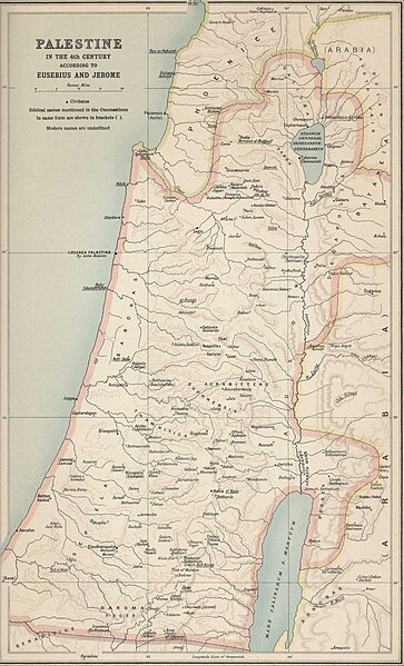
English: Palestine according to Eusbius and Jerome, as per Atlas of the Historical Geography of the Holy Land by George Adam Smith in 1915 |
| তারিখ | |
| উৎস | |
| লেখক | George Adam Smith |
.jpg)
লাইসেন্স প্রদান
This media file is in the public domain in the United States. This applies to U.S. works where the copyright has expired, often because its first publication occurred prior to January 1, 1929, and if not then due to lack of notice or renewal. See this page for further explanation.
|
 | |
 |
This image might not be in the public domain outside of the United States; this especially applies in the countries and areas that do not apply the rule of the shorter term for US works, such as Canada, Mainland China (not Hong Kong or Macao), Germany, Mexico, and Switzerland. The creator and year of publication are essential information and must be provided. See Wikipedia:Public domain and Wikipedia:Copyrights for more details.
|
ফাইলের ইতিহাস
যেকোনো তারিখ/সময়ে ক্লিক করে দেখুন ফাইলটি তখন কী অবস্থায় ছিল।
| তারিখ/সময় | সংক্ষেপচিত্র | মাত্রা | ব্যবহারকারী | মন্তব্য | |
|---|---|---|---|---|---|
| বর্তমান | ০৮:০৩, ২৪ ডিসেম্বর ২০২৩ | | ২,৪১৬ × ৩,৯৮৭ (৫.৫৫ মেগাবাইট) | DEGA MD | Higher resolution version of the same map. |
| ১৪:০২, ৭ আগস্ট ২০১২ |  | ৫৫৯ × ৯২৫ (১২৬ কিলোবাইট) | Onceinawhile |
সংযোগসমূহ
নিচের পৃষ্ঠা(গুলো) থেকে এই ছবিতে সংযোগ আছে:
ফাইলের বৈশ্বিক ব্যবহার
নিচের অন্যান্য উইকিগুলো এই ফাইলটি ব্যবহার করে:
- ace.wikipedia.org-এ ব্যবহার
- anp.wikipedia.org-এ ব্যবহার
- ar.wikipedia.org-এ ব্যবহার
- az.wikipedia.org-এ ব্যবহার
- crh.wikipedia.org-এ ব্যবহার
- da.wikipedia.org-এ ব্যবহার
- de.wikipedia.org-এ ব্যবহার
- diq.wikipedia.org-এ ব্যবহার
- el.wikipedia.org-এ ব্যবহার
- en.wikipedia.org-এ ব্যবহার
- es.wikipedia.org-এ ব্যবহার
- et.wikipedia.org-এ ব্যবহার
- eu.wikipedia.org-এ ব্যবহার
- fa.wikipedia.org-এ ব্যবহার
- fr.wikipedia.org-এ ব্যবহার
- gag.wikipedia.org-এ ব্যবহার
- he.wikipedia.org-এ ব্যবহার
- hi.wikipedia.org-এ ব্যবহার
- hr.wikipedia.org-এ ব্যবহার
- hsb.wikipedia.org-এ ব্যবহার
- hu.wikipedia.org-এ ব্যবহার
- hy.wikipedia.org-এ ব্যবহার
- hyw.wikipedia.org-এ ব্যবহার
- id.wikipedia.org-এ ব্যবহার
- is.wikipedia.org-এ ব্যবহার
- kg.wikipedia.org-এ ব্যবহার
- kk.wikipedia.org-এ ব্যবহার
- lad.wikipedia.org-এ ব্যবহার
- lij.wikipedia.org-এ ব্যবহার
- lv.wikipedia.org-এ ব্যবহার
- nl.wikipedia.org-এ ব্যবহার
- pl.wikipedia.org-এ ব্যবহার
- pnb.wikipedia.org-এ ব্যবহার
- pt.wikipedia.org-এ ব্যবহার
- qu.wikipedia.org-এ ব্যবহার
এই ফাইলের অন্যান্য বৈশ্বিক ব্যবহার দেখুন।