
চিত্র:Map of Indonesia Demis.png

এই প্রাকদর্শনের আকার: ৮০০ × ৩৫৯ পিক্সেল। অন্যান্য আকারসমূহ: ৩২০ × ১৪৪ পিক্সেল | ৬৪০ × ২৮৭ পিক্সেল | ১,৪৯২ × ৬৭০ পিক্সেল।
পূর্ণ রেজোলিউশন (১,৪৯২ × ৬৭০ পিক্সেল, ফাইলের আকার: ৩৪৫ কিলোবাইট, এমআইএমই ধরন: image/png)
| এই ফাইলটি উইকিমিডিয়া কমন্স থেকে নেওয়া। সেখানের বর্ণনা পাতার বিস্তারিত নিম্নে দেখানো হলো। (সম্পাদনা)
|
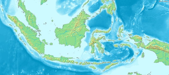
Map of Indonesia
Bounding box West 93°, South -12°, East 142°, North 10°. Center at 1°00′00″S 117°30′00″E / 1.00000°S 117.50000°E.
This image is in the public domain because it came from the site https://www.demis.nl/products/web-map-server/examples/ and was released by the copyright holder. Permission is granted to copy, distribute and/or modify this map since it is based on free of copyright images from: www.demis.nl. See also approval email on de.wp and its clarification.
|
| This work has been released into the public domain by its copyright holder, www.demis.nl. This applies worldwide. কিছু দেশে এটি আইনত সিদ্ধ নাও হতে পারে, যদি তাই হয়: www.demis.nl যে-কাউকে যেকোনো উদ্দেশ্যে, বিনাশর্তে এই কাজটি ব্যবহারের অনুমতি প্রদান করেন, যদি না সেই শর্তগুলো আইনত প্রয়োজনীয় হয়।
|
ফাইলের ইতিহাস
যেকোনো তারিখ/সময়ে ক্লিক করে দেখুন ফাইলটি তখন কী অবস্থায় ছিল।
| তারিখ/সময় | সংক্ষেপচিত্র | মাত্রা | ব্যবহারকারী | মন্তব্য | |
|---|---|---|---|---|---|
| বর্তমান | ১৭:৪৮, ২০ ডিসেম্বর ২০০৬ | | ১,৪৯২ × ৬৭০ (৩৪৫ কিলোবাইট) | Mats Halldin~commonswiki | Map of Indonesia Bounding box West 93°, South -12°, East 142°, North 10°. Center at {{coor d|1.00000|S|117.50000|E|scale:13200000}}. {{demis-pd}} Category:Maps of Indonesia |
সংযোগসমূহ
নিচের পৃষ্ঠা(গুলো) থেকে এই ছবিতে সংযোগ আছে:
ফাইলের বৈশ্বিক ব্যবহার
নিচের অন্যান্য উইকিগুলো এই ফাইলটি ব্যবহার করে:
- ar.wikipedia.org-এ ব্যবহার
- bg.wikipedia.org-এ ব্যবহার
- es.wikipedia.org-এ ব্যবহার
- et.wikipedia.org-এ ব্যবহার
- eu.wikipedia.org-এ ব্যবহার
- fr.wikipedia.org-এ ব্যবহার
- hr.wikipedia.org-এ ব্যবহার
- hy.wikipedia.org-এ ব্যবহার
- id.wikipedia.org-এ ব্যবহার
- ja.wikipedia.org-এ ব্যবহার
- km.wikipedia.org-এ ব্যবহার
- ko.wikipedia.org-এ ব্যবহার
- la.wikipedia.org-এ ব্যবহার
- nl.wikipedia.org-এ ব্যবহার
- pl.wikipedia.org-এ ব্যবহার
- pnb.wikipedia.org-এ ব্যবহার
- sq.wikipedia.org-এ ব্যবহার
- uk.wikipedia.org-এ ব্যবহার
- vep.wikipedia.org-এ ব্যবহার
- vi.wikipedia.org-এ ব্যবহার