
চিত্র:Intracoastal Waterway Louisiana.jpg

এই প্রাকদর্শনের আকার: ৮০০ × ৫৩৩ পিক্সেল। অন্যান্য আকারসমূহ: ৩২০ × ২১৩ পিক্সেল | ৬৪০ × ৪২৭ পিক্সেল | ১,০২৪ × ৬৮৩ পিক্সেল | ১,৫০০ × ১,০০০ পিক্সেল।
পূর্ণ রেজোলিউশন (১,৫০০ × ১,০০০ পিক্সেল, ফাইলের আকার: ৫০৮ কিলোবাইট, এমআইএমই ধরন: image/jpeg)
| এই ফাইলটি উইকিমিডিয়া কমন্স থেকে নেওয়া। সেখানের বর্ণনা পাতার বিস্তারিত নিম্নে দেখানো হলো। (সম্পাদনা)
|
| বিবরণ |
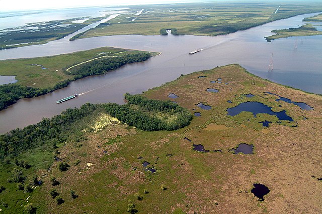
English: Navigation on the Gulf Intracoastal Waterway (GIWW), where it intersects with Bayou Perot in Louisiana, USA. The view in this picture is to the south. The GIWW runs left–right across the picture. The bayou comes in from the left and enters Lake Salvador on the right. The bayou is the boundary between Jefferson Parish in the foreground and Lafourche Parish in the distance beyond the bayou. |
|||
| তারিখ | ||||
| উৎস |
U.S. Army Corps of Engineers Digital Visual Library Image page Image description page Digital Visual Library home page |
|||
| লেখক | Lane Lefort, U.S. Army Corps of Engineers | |||
| অনুমতি (এ ফাইলের পুনঃব্যবহার) |
|
|||
| অবস্থান | New Orleans, Louisiana, USA |
| ক্যামেরার অবস্থান | | এটি এবং অন্যান্য ছবি তাদের অবস্থানের উপর: ওপেনস্ট্রিটম্যাপ |
|---|
ফাইলের ইতিহাস
যেকোনো তারিখ/সময়ে ক্লিক করে দেখুন ফাইলটি তখন কী অবস্থায় ছিল।
| তারিখ/সময় | সংক্ষেপচিত্র | মাত্রা | ব্যবহারকারী | মন্তব্য | |
|---|---|---|---|---|---|
| বর্তমান | ২২:১৪, ১ এপ্রিল ২০০৭ | | ১,৫০০ × ১,০০০ (৫০৮ কিলোবাইট) | DanMS | {{Information | Description = {{en|Navigation on the Gulf Intracoastal Waterway (GIWW), where it intersects with Bayou Perot, in the vicinity of New Orleans, USA.}} | Source = U.S. Army Corps of Engineers Digital Visual Library<br />[http://ima |
সংযোগসমূহ
নিচের পৃষ্ঠা(গুলো) থেকে এই ছবিতে সংযোগ আছে:
ফাইলের বৈশ্বিক ব্যবহার
নিচের অন্যান্য উইকিগুলো এই ফাইলটি ব্যবহার করে:
- af.wikipedia.org-এ ব্যবহার
- arz.wikipedia.org-এ ব্যবহার
- cs.wikipedia.org-এ ব্যবহার
- de.wikipedia.org-এ ব্যবহার
- en.wikipedia.org-এ ব্যবহার
- es.wikipedia.org-এ ব্যবহার
- fi.wikipedia.org-এ ব্যবহার
- fr.wikipedia.org-এ ব্যবহার
- gu.wikipedia.org-এ ব্যবহার
- he.wikipedia.org-এ ব্যবহার
- it.wikipedia.org-এ ব্যবহার
- ja.wikipedia.org-এ ব্যবহার
- kn.wikipedia.org-এ ব্যবহার
- pam.wikipedia.org-এ ব্যবহার
- ro.wikipedia.org-এ ব্যবহার
- ru.wikipedia.org-এ ব্যবহার
- ur.wikipedia.org-এ ব্যবহার
- vi.wikipedia.org-এ ব্যবহার
- zh.wikipedia.org-এ ব্যবহার