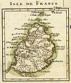
চিত্র:Bonne - Isle de France (Detail).jpg

এই প্রাকদর্শনের আকার: ৫০৯ × ৬০০ পিক্সেল। অন্যান্য আকারসমূহ: ২০৪ × ২৪০ পিক্সেল | ৪০৭ × ৪৮০ পিক্সেল | ৬৫২ × ৭৬৮ পিক্সেল | ১,০৪৫ × ১,২৩১ পিক্সেল।
পূর্ণ রেজোলিউশন (১,০৪৫ × ১,২৩১ পিক্সেল, ফাইলের আকার: ৩৮৮ কিলোবাইট, এমআইএমই ধরন: image/jpeg)
ফাইলের ইতিহাস
যেকোনো তারিখ/সময়ে ক্লিক করে দেখুন ফাইলটি তখন কী অবস্থায় ছিল।
| তারিখ/সময় | সংক্ষেপচিত্র | মাত্রা | ব্যবহারকারী | মন্তব্য | |
|---|---|---|---|---|---|
| বর্তমান | ০০:৫৩, ১৫ মে ২০০৮ |  | ১,০৪৫ × ১,২৩১ (৩৮৮ কিলোবাইট) | Sting | Some cleaning |
| ২২:৪৫, ১ মার্চ ২০০৭ |  | ১,০৫৬ × ১,২৪০ (৩০৭ কিলোবাইট) | Frank Schulenburg | Rigobert Bonne (1727–1795) ''Isle de France'', Nebenkarte aus: Partie de la cote orientale d’Afrique avec l’Isle de Madagascar et les cartes particulieres des Isles de France et de Bourbon. Projette et assujetie aux observati |
সংযোগসমূহ
নিচের পৃষ্ঠা(গুলো) থেকে এই ছবিতে সংযোগ আছে:
ফাইলের বৈশ্বিক ব্যবহার
নিচের অন্যান্য উইকিগুলো এই ফাইলটি ব্যবহার করে:
- ar.wikipedia.org-এ ব্যবহার
- ca.wikipedia.org-এ ব্যবহার
- cs.wikipedia.org-এ ব্যবহার
- da.wikipedia.org-এ ব্যবহার
- de.wikipedia.org-এ ব্যবহার
- en.wikipedia.org-এ ব্যবহার
- es.wikipedia.org-এ ব্যবহার
- fr.wikipedia.org-এ ব্যবহার
- Liste des colonies françaises
- Mascareignes
- Histoire de Maurice
- Expédition Baudin
- Voyage de découvertes aux terres australes
- Wikipédia:Atelier graphique/Cartes/Archives/juillet 2008
- Lys (1746)
- Alcide (1743)
- Utilisateur:Skiff/A illustrer
- Escadre Suffren dans l'océan Indien
- Campagne de l'île Maurice
- Utilisateur:Exp JC/Brouillon
- Étienne Bottineau
- Nauscopie
- he.wikipedia.org-এ ব্যবহার
- io.wikipedia.org-এ ব্যবহার
- mt.wikipedia.org-এ ব্যবহার
- nl.wikipedia.org-এ ব্যবহার
- no.wikipedia.org-এ ব্যবহার
- pt.wikipedia.org-এ ব্যবহার
- tr.wikipedia.org-এ ব্যবহার
- vec.wikipedia.org-এ ব্যবহার
- vi.wikipedia.org-এ ব্যবহার
- www.wikidata.org-এ ব্যবহার
