সাঁ পিয়ের ও মিকলোঁ: সংশোধিত সংস্করণের মধ্যে পার্থক্য
বিষয়বস্তু বিয়োগ হয়েছে বিষয়বস্তু যোগ হয়েছে
সম্প্রসারণ |
অ স্থানাঙ্ক |
||
| ১ নং লাইন: | ১ নং লাইন: | ||
{{উইকিউপাত্ত স্থানাঙ্ক}} |
|||
{{Infobox Country |
{{Infobox Country |
||
| native_name = ''Collectivité territoriale de Saint-Pierre-et-Miquelon'' |
| native_name = ''Collectivité territoriale de Saint-Pierre-et-Miquelon'' |
||
| ৩৭ নং লাইন: | ৩৮ নং লাইন: | ||
| percent_water = negligible |
| percent_water = negligible |
||
| population_estimate_rank = 223rd |
| population_estimate_rank = 223rd |
||
| population_census = ৬,০৮০<ref name=population>{{ |
| population_census = ৬,০৮০<ref name=population>{{ওয়েব উদ্ধৃতি|url=http://www.insee.fr/fr/ppp/bases-de-donnees/recensement/populations-legales/france-departements.asp?annee=2011 |title=Populations légales 2011 pour les départements et les collectivités d'outre-mer|first=[[Cabinet of France|Government of France]]|last=[[INSEE]]|accessdate=26 January 2014|language=fr}}</ref> |
||
| population_census_year = জানু ২০১১ |
| population_census_year = জানু ২০১১ |
||
| population_density_km2 = ২৫ |
| population_density_km2 = ২৫ |
||
| population_density_sq_mi = |
| population_density_sq_mi = |
||
| population_density_rank = ১৮৮ তম |
| population_density_rank = ১৮৮ তম |
||
| GDP_PPP = €161.131 million<ref name="pib-v">{{ |
| GDP_PPP = €161.131 million<ref name="pib-v">{{ওয়েব উদ্ধৃতি|url=http://www.iedom.fr/IMG/pdf/cerom4_spm.pdf |title=Evaluation du PIB 2004 de Saint-Pierre-et-Miquelon – janvier 2007 |page=24 |format=PDF |accessdate=8 February 2013}}</ref> |
||
| GDP_PPP_year = 2004 |
| GDP_PPP_year = 2004 |
||
| GDP_PPP_per_capita = €২৬,০৭৩<ref name="pib-v"/> |
| GDP_PPP_per_capita = €২৬,০৭৩<ref name="pib-v"/> |
||
২৩:৫১, ১৩ আগস্ট ২০১৭ তারিখে সংশোধিত সংস্করণ
Territorial Collectivity of Saint Pierre and Miquelon Collectivité territoriale de Saint-Pierre-et-Miquelon | |
|---|---|
জাতীয় সঙ্গীত: La Marseillaise | |
 | |
| রাজধানী ও বৃহত্তম নগরী বা বসতি | Saint-Pierre |
| সরকারি ভাষা | French |
| সরকার | Dependent territory |
| Nicolas Sarkozy | |
| Stéphane Artano | |
• Prefect | Yves Fauqueur |
| Overseas collectivity of France | |
• Ceded by the UK† | ৩০ মে ১৮৪১ |
| 27 October 1946 | |
| 17 July 1976 | |
| 11 June 1985 | |
• Overseas collectivity | ২৮ মার্চ ২০০৩ |
| আয়তন | |
• মোট | ২৪২ কিমি২ (৯৩ মা২) (২০৮ তম) |
• পানি (%) | negligible |
| জনসংখ্যা | |
• জানু ২০১১ আদমশুমারি | ৬,০৮০[১] |
• ঘনত্ব | ২৫/কিমি২ (৬৪.৭/বর্গমাইল) (১৮৮ তম) |
| জিডিপি (পিপিপি) | 2004 আনুমানিক |
• মোট | €161.131 million[২] |
• মাথাপিছু | €২৬,০৭৩[২] |
| মুদ্রা | ইউরো (€) (EUR) |
| সময় অঞ্চল | ইউটিসি-3 (PMST) |
• গ্রীষ্মকালীন (ডিএসটি) | ইউটিসি-2 (PMDT) |
| কলিং কোড | 508 |
| ইন্টারনেট টিএলডি | .pm |
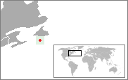
সাঁ পিয়ের ও মিকলোঁ উত্তর আটলান্টিক মহাসাগরে অবস্থিত একটি দ্বীপপুঞ্জ। দ্বীপগুলি ফ্রান্সের অংশ। {{#coordinates:}}: প্রতি পাতায় একাধিক প্রাথমিক ট্যাগ থাকতে পারবে না
তথ্যসূত্র
- ↑ INSEE, Government of France। "Populations légales 2011 pour les départements et les collectivités d'outre-mer" (ফরাসি ভাষায়)। সংগ্রহের তারিখ ২৬ জানুয়ারি ২০১৪।
- ↑ ক খ "Evaluation du PIB 2004 de Saint-Pierre-et-Miquelon – janvier 2007" (PDF)। পৃষ্ঠা 24। সংগ্রহের তারিখ ৮ ফেব্রুয়ারি ২০১৩।


