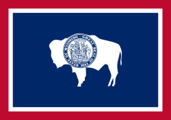
ওয়াইয়োমিং: সংশোধিত সংস্করণের মধ্যে পার্থক্য
বিষয়বস্তু বিয়োগ হয়েছে বিষয়বস্তু যোগ হয়েছে
infobox added |
অ টেমপ্লেটে সংশোধন |
||
| ৩৩ নং লাইন: | ৩৩ নং লাইন: | ||
| PCWater = 0.7 |
| PCWater = 0.7 |
||
| PopRank = 50th |
| PopRank = 50th |
||
| 2010Pop = 582,658 (2013 estimate)<ref name=PopEstUS>{{ |
| 2010Pop = 582,658 (2013 estimate)<ref name=PopEstUS>{{ওয়েব উদ্ধৃতি|url=http://www.census.gov/popest/data/state/totals/2012/tables/NST-EST2012-01.csv|title=Annual Estimates of the Population for the United States, Regions, States, and Puerto Rico: April 1, 2010 to July 1, 2012|format=[[comma-separated values|CSV]]|work=2012 Population Estimates|publisher=[[United States Census Bureau]], Population Division|date=December 2012|accessdate=December 22, 2012}}</ref> |
||
| DensityRank = 49th |
| DensityRank = 49th |
||
| 2000DensityUS = 5.85 |
| 2000DensityUS = 5.85 |
||
| ৪৬ নং লাইন: | ৪৬ নং লাইন: | ||
| LengthUS = 280 |
| LengthUS = 280 |
||
| Length = 450 |
| Length = 450 |
||
| HighestPoint = [[Gannett Peak]]<ref>{{cite ngs|id=OW0356|designation=Gannett Peak Cairn|accessdate=October 24, 2011}}</ref><ref name=USGS>{{ |
| HighestPoint = [[Gannett Peak]]<ref>{{cite ngs|id=OW0356|designation=Gannett Peak Cairn|accessdate=October 24, 2011}}</ref><ref name=USGS>{{ওয়েব উদ্ধৃতি|url=http://egsc.usgs.gov/isb//pubs/booklets/elvadist/elvadist.html|title=Elevations and Distances in the United States|publisher=[[United States Geological Survey]]|year=2001|accessdate=July 13, 2014}}</ref><ref name=NAVD88>Elevation adjusted to [[North American Vertical Datum of 1988]].</ref> |
||
| HighestElevUS = 13,809 |
| HighestElevUS = 13,809 |
||
| HighestElev = 4209.1 |
| HighestElev = 4209.1 |
||
| ১০০ নং লাইন: | ১০০ নং লাইন: | ||
== তথ্যসূত্র == |
== তথ্যসূত্র == |
||
{{সূত্র তালিকা}} |
|||
{{reflist}} |
|||
== আরও দেখুন == |
== আরও দেখুন == |
||
২৩:১২, ২১ মার্চ ২০১৭ তারিখে সংশোধিত সংস্করণ
| ওয়াইয়োমিং | |
|---|---|
| রাষ্ট্র | মার্কিন যুক্তরাষ্ট্র |
| রাজ্য প্রতিষ্ঠার আগে | Wyoming Territory |
| ইউনিয়নে অন্তর্ভুক্তি | July 10, 1890 (44th) |
| বৃহত্তম মেট্রো | Cheyenne Metro Area |
| সরকার | |
| • গভর্নর | Matt Mead (R) |
| • লেফটেন্যান্ট গভর্নর | Max Maxfield (R) |
| জনসংখ্যা | |
| • মোট | ৫,৮২,৬৫৮ (২,০১৩ estimate)[১] |
| • জনঘনত্ব | ৫.৮৫/বর্গমাইল (২.২৬/বর্গকিমি) |
| ভাষা | |
| • দাপ্তরিক ভাষা | ইংরেজি |
| অক্ষাংশ | 41°N to 45°N |
| দ্রাঘিমাংশ | 104°3'W to 111°3'W |
| Wyoming-এর অঙ্গরাজ্য প্রতীক | |
|---|---|
 | |
 | |
| জীবনযাপন | |
| পাখি | Western Meadowlark (Sturnella neglecta) |
| মাছ | Cutthroat trout (Oncorhynchus clarki) |
| ফুল | Wyoming Indian paintbrush (Castilleja linariifolia) |
| ঘাস | Western Wheatgrass (Pascopyrum smithii) |
| স্তন্যপায়ী | American Bison (Bison bison) |
| সরীসৃপ | Horned lizard (Phrynosoma douglassi brevirostre) |
| বৃক্ষ | Plains Cottonwood (Populus sargentii) |
| জড় খেতাবে | |
| জীবাশ্ম | Knightia |
| খনিজ | Nephrite |
| নীতিবাক্য | Equal Rights (motto) |
| মৃত্তিকা | Forkwood (unofficial) |
| সঙ্গীত | Wyoming (song) by Charles E. Winter & George E. Knapp |
| অঙ্গরাজ্য রুট চিহ্নিতকারী | |
 | |
| অঙ্গরাজ্য কোয়ার্টার | |
| Wyoming quarter dollar coin 2007-এ প্রকাশিত | |
| যুক্তরাষ্ট্রের অঙ্গরাজ্য প্রতীকগুলির তালিকা | |
ওয়াইয়োমিং মার্কিন যুক্তরাষ্ট্রের একটি অঙ্গরাজ্য। ১৮৯০ সালে যুক্তরাষ্ট্রের ৪৪তম অঙ্গরাজ্য হিসেবে ওয়াইয়োমিং অন্তর্ভুক্ত হয়।
তথ্যসূত্র
- ↑ "Annual Estimates of the Population for the United States, Regions, States, and Puerto Rico: April 1, 2010 to July 1, 2012" (CSV)। 2012 Population Estimates। United States Census Bureau, Population Division। ডিসেম্বর ২০১২। সংগ্রহের তারিখ ডিসেম্বর ২২, ২০১২।
আরও দেখুন
বহিঃসংযোগ
| এই নিবন্ধটি অসম্পূর্ণ। আপনি চাইলে এটিকে সম্প্রসারিত করে উইকিপিডিয়াকে সাহায্য করতে পারেন। |
