
চিত্র:LocationMauritius.png
এর চেয়ে বেশি রেজোলিউশন লভ্য নয়।
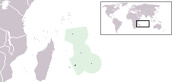
LocationMauritius.png (২৪৮ × ১১৭ পিক্সেল, ফাইলের আকার: ৩ কিলোবাইট, এমআইএমই ধরন: image/png)
| এই ফাইলটি উইকিমিডিয়া কমন্স থেকে নেওয়া। সেখানের বর্ণনা পাতার বিস্তারিত নিম্নে দেখানো হলো। (সম্পাদনা)
|

|
This locator map image could be re-created using vector graphics as an SVG file. This has several advantages; see Commons:Media for cleanup for more information. If an SVG form of this image is available, please upload it and afterwards replace this template with
{{vector version available|new image name}}.
It is recommended to name the SVG file “LocationMauritius.svg”—then the template Vector version available (or Vva) does not need the new image name parameter. |
Location map for the Mauritius.
Originally created for English Wikipedia by Vardion.
| |
এই কাজের প্রণেতা Vardion উইকিমিডিয়া কমন্স প্রকল্পের কাজটি পাবলিক ডোমেইনে প্রকাশ করেছেন। এটি বিশ্বব্যাপী প্রযোজ্য হবে। যে ক্ষেত্রে এটি আইনত সম্ভব নয়: |
ফাইলের ইতিহাস
যেকোনো তারিখ/সময়ে ক্লিক করে দেখুন ফাইলটি তখন কী অবস্থায় ছিল।
| তারিখ/সময় | সংক্ষেপচিত্র | মাত্রা | ব্যবহারকারী | মন্তব্য | |
|---|---|---|---|---|---|
| বর্তমান | ০১:২৮, ১৬ জানুয়ারি ২০১২ | | ২৪৮ × ১১৭ (৩ কিলোবাইট) | Ras67 | cropped |
| ১৪:০২, ১ জুন ২০০৮ |  | ২৫০ × ১১৯ (৫ কিলোবাইট) | Panos84 | {{Information= Location of the island nation of Mauritius and its exclusive economic zone. |Source= Own work |Date= 01 June 2008 |Author= Panos84 (Panagiotis V. Lazaridis) }} | |
| ০২:৫৫, ৫ মার্চ ২০০৮ |  | ২৫০ × ১১৯ (৫ কিলোবাইট) | Panos84 | Location of the island nation of Mauritius and its exclusive economic zone. | |
| ১৮:৩২, ১২ ডিসেম্বর ২০০৪ |  | ২৫০ × ১১৫ (৫ কিলোবাইট) | EugeneZelenko | Location map for the Mauritius.<br/>Originally created for English Wikipedia by Vardion.<br/>{{PD}}<br/>Category:Country locator maps |
সংযোগসমূহ
এই ফাইল ব্যবহার করে এমন কোনো পাতা নেই।
ফাইলের বৈশ্বিক ব্যবহার
নিচের অন্যান্য উইকিগুলো এই ফাইলটি ব্যবহার করে:
- als.wikipedia.org-এ ব্যবহার
- am.wikipedia.org-এ ব্যবহার
- ar.wikipedia.org-এ ব্যবহার
- arz.wikipedia.org-এ ব্যবহার
- ban.wikipedia.org-এ ব্যবহার
- be-tarask.wikipedia.org-এ ব্যবহার
- be.wikipedia.org-এ ব্যবহার
- bg.wikipedia.org-এ ব্যবহার
- bjn.wikipedia.org-এ ব্যবহার
- bo.wikipedia.org-এ ব্যবহার
- bpy.wikipedia.org-এ ব্যবহার
- bs.wikipedia.org-এ ব্যবহার
- ca.wikipedia.org-এ ব্যবহার
- cv.wikipedia.org-এ ব্যবহার
- da.wikipedia.org-এ ব্যবহার
- de.wiktionary.org-এ ব্যবহার
- en.wikipedia.org-এ ব্যবহার
- User:DanielZM/test
- User:Chris huh/List of African countries
- Portal:Africa/Countries/Selected country
- Portal:Africa/Countries/Selected country/33
- Outline of Mauritius
- List of Mauritius-related topics
- Category:Roman Catholic dioceses in Mauritius
- Wikipedia:Graphics Lab/Map workshop/Archive/Nov 2009
- Wikipedia:Graphics Lab/Map workshop/Archive/Jan 2010
- List of non-marine molluscs of Mauritius
- List of moths of Mauritius
- List of butterflies of Mauritius
- en.wikinews.org-এ ব্যবহার
- en.wiktionary.org-এ ব্যবহার
- eo.wikipedia.org-এ ব্যবহার
- eo.wiktionary.org-এ ব্যবহার
- es.wikipedia.org-এ ব্যবহার
- es.wikinews.org-এ ব্যবহার
- et.wiktionary.org-এ ব্যবহার
- ext.wikipedia.org-এ ব্যবহার
- fa.wikipedia.org-এ ব্যবহার
- fiu-vro.wikipedia.org-এ ব্যবহার
এই ফাইলের অন্যান্য বৈশ্বিক ব্যবহার দেখুন।