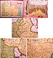
চিত্র:Iran 1748.jpg

এই প্রাকদর্শনের আকার: ৫৫০ × ৬০০ পিক্সেল। অন্যান্য আকারসমূহ: ২২০ × ২৪০ পিক্সেল | ৪৪০ × ৪৮০ পিক্সেল | ৮০৬ × ৮৭৯ পিক্সেল।
পূর্ণ রেজোলিউশন (৮০৬ × ৮৭৯ পিক্সেল, ফাইলের আকার: ২১৮ কিলোবাইট, এমআইএমই ধরন: image/jpeg)
ফাইলের ইতিহাস
যেকোনো তারিখ/সময়ে ক্লিক করে দেখুন ফাইলটি তখন কী অবস্থায় ছিল।
| তারিখ/সময় | সংক্ষেপচিত্র | মাত্রা | ব্যবহারকারী | মন্তব্য | |
|---|---|---|---|---|---|
| বর্তমান | ১৮:০৯, ৫ ডিসেম্বর ২০১১ |  | ৮০৬ × ৮৭৯ (২১৮ কিলোবাইট) | File Upload Bot (Magnus Manske) | {{BotMoveToCommons|en.wikipedia|year={{subst:CURRENTYEAR}}|month={{subst:CURRENTMONTHNAME}}|day={{subst:CURRENTDAY}}}} {{Information |Description={{en|"L'Empire De Perse" issued 1748, Paris, by Le Rouge. A nicely detailed mid-18th century map of Persia. |
সংযোগসমূহ
নিচের পৃষ্ঠা(গুলো) থেকে এই ছবিতে সংযোগ আছে:
ফাইলের বৈশ্বিক ব্যবহার
নিচের অন্যান্য উইকিগুলো এই ফাইলটি ব্যবহার করে:
- azb.wikipedia.org-এ ব্যবহার
- ca.wikipedia.org-এ ব্যবহার
- en.wikipedia.org-এ ব্যবহার
- fa.wikipedia.org-এ ব্যবহার
- fr.wikipedia.org-এ ব্যবহার
- it.wikipedia.org-এ ব্যবহার
- ko.wikipedia.org-এ ব্যবহার
- nn.wikipedia.org-এ ব্যবহার
- pnb.wikipedia.org-এ ব্যবহার
- tr.wikipedia.org-এ ব্যবহার
- ur.wikipedia.org-এ ব্যবহার
- www.wikidata.org-এ ব্যবহার
