
চিত্র:Babylon 1829 cropped.gif
Babylon_1829_cropped.gif (৪৮৯ × ৩৫৬ পিক্সেল, ফাইলের আকার: ৭৫ কিলোবাইট, এমআইএমই ধরন: image/gif)
| এই ফাইলটি উইকিমিডিয়া কমন্স থেকে নেওয়া। সেখানের বর্ণনা পাতার বিস্তারিত নিম্নে দেখানো হলো। (সম্পাদনা)
|
| বিবরণ |
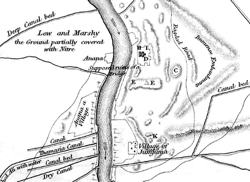
English: Map of the site of Babylon prior to its excavation later in the 19th century. |
| তারিখ | (UTC) |
| উৎস |
|
| লেখক |
|
| এটি একটি পুনঃসম্পাদিত চিত্র, যার মানে হল যে এটি ডিজিটালরূপে এটির মূল সংস্করণ থেকে পরিবর্তন করা হয়েছে। পরিবর্তন: Cropped to show southern area, highlighting the Jumjuma mound। আসলটি দেখা যাবে এখানে: Babylon 1829.jpg। ChrisO কর্তৃক এটি পরিবর্তিত হয়েছে।
|
|
এই কর্মটি এর উৎস দেশে পাবলিক ডোমেইনে রয়েছে এবং অন্যান্য দেশ ও অঞ্চলে যেখানে কপিরাটের সময়সীমা হচ্ছে লেখকের জীবন যোগ ৭০ বছর বা তাঁর কম।
| |
| এই ফাইলটি কপিরাইট আইনের আওতায় জানা সকল বাধানিষেধ মুক্ত বলে চিহ্নিত হয়েছে, যার মধ্যে সম্পর্কিত সকল স্বত্ব ও নেইবারিং সত্ত্ব সংযুক্ত। | |
মূল আপলোড লগ
This image is a derivative work of the following images:
- File:Babylon_1829.jpg licensed with PD-old
- 2010-06-06T22:50:24Z ChrisO 1065x1464 (228517 Bytes) {{Information |Description={{en|1=Map of the site of Babylon prior to its excavation later in the 19th century.}} |Source=Ground Plan of the Remains at & near Babylon |Author=Captain R. Mignan |Date=October 1829 |Permission=
Uploaded with derivativeFX
ফাইলের ইতিহাস
যেকোনো তারিখ/সময়ে ক্লিক করে দেখুন ফাইলটি তখন কী অবস্থায় ছিল।
| তারিখ/সময় | সংক্ষেপচিত্র | মাত্রা | ব্যবহারকারী | মন্তব্য | |
|---|---|---|---|---|---|
| বর্তমান | ২০:৫৬, ১৬ জুন ২০১০ | | ৪৮৯ × ৩৫৬ (৭৫ কিলোবাইট) | ChrisO | |
| ২৩:০৭, ৬ জুন ২০১০ |  | ৪৮৯ × ৩৫৬ (৮৮ কিলোবাইট) | ChrisO | {{Information |Description={{en|1=Map of the site of Babylon prior to its excavation later in the 19th century.}} |Source=*File:Babylon_1829.jpg |Date=2010-06-06 23:07 (UTC) |Author=*File:Babylon_1829.jpg: Captain R. Mignan *derivative work: ~ |
সংযোগসমূহ
নিচের পৃষ্ঠা(গুলো) থেকে এই ছবিতে সংযোগ আছে:
ফাইলের বৈশ্বিক ব্যবহার
নিচের অন্যান্য উইকিগুলো এই ফাইলটি ব্যবহার করে:
- ar.wikipedia.org-এ ব্যবহার
- en.wikipedia.org-এ ব্যবহার
- es.wikipedia.org-এ ব্যবহার
- fa.wikipedia.org-এ ব্যবহার
- fr.wikipedia.org-এ ব্যবহার
- he.wikipedia.org-এ ব্যবহার
- hyw.wikipedia.org-এ ব্যবহার
- no.wikipedia.org-এ ব্যবহার
- uk.wikipedia.org-এ ব্যবহার