
চিত্র:121.55000E 29.86667N Ningbo.png

এই প্রাকদর্শনের আকার: ৭৯০ × ৫৯৯ পিক্সেল। অন্যান্য আকারসমূহ: ৩১৭ × ২৪০ পিক্সেল | ৬৩৩ × ৪৮০ পিক্সেল | ৮১২ × ৬১৬ পিক্সেল।
পূর্ণ রেজোলিউশন (৮১২ × ৬১৬ পিক্সেল, ফাইলের আকার: ৩৫৫ কিলোবাইট, এমআইএমই ধরন: image/png)
| এই ফাইলটি উইকিমিডিয়া কমন্স থেকে নেওয়া। সেখানের বর্ণনা পাতার বিস্তারিত নিম্নে দেখানো হলো। (সম্পাদনা)
|
| বিবরণ |
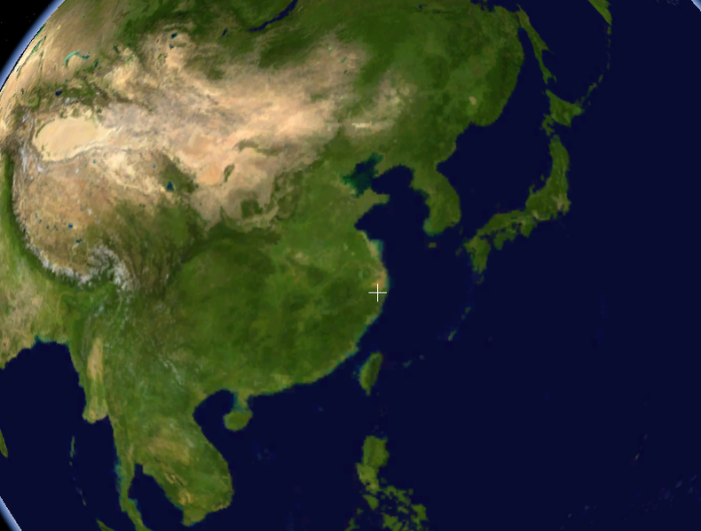
English: Screenshot taken using the Blue Marble dataset in NASA WorldWind showing the location of the Port of Ningbo, China (where the cross is). Cropped a bit around the edges, removed the NASA logo at the lower right of the image. |
|||
| তারিখ | অজানা তারিখ | |||
| উৎস | Created with NASA WorldWind by User:Oaktree_b using Blue Marble layer | |||
| লেখক | NASA | |||
| অনুমতি (এ ফাইলের পুনঃব্যবহার) |
|

ফাইলের ইতিহাস
যেকোনো তারিখ/সময়ে ক্লিক করে দেখুন ফাইলটি তখন কী অবস্থায় ছিল।
| তারিখ/সময় | সংক্ষেপচিত্র | মাত্রা | ব্যবহারকারী | মন্তব্য | |
|---|---|---|---|---|---|
| বর্তমান | ০২:৩৩, ২৫ জুলাই ২০১১ | | ৮১২ × ৬১৬ (৩৫৫ কিলোবাইট) | Oaktree b | {{Information |Description ={{en|1=Screenshot taken using the Blue Marble dataset in NASA WorldWind showing the location of the Port of Ningbo, China (where the cross is). Cropped a bit around the edges, removed the NASA logo at the lower right of the |
সংযোগসমূহ
নিচের পৃষ্ঠা(গুলো) থেকে এই ছবিতে সংযোগ আছে: