দক্ষিণ এশিয়ার বিশ্ব ঐতিহ্যবাহী স্থানসমূহের তালিকা

উইকিপিডিয়া, মুক্ত বিশ্বকোষ থেকে

ইউনেস্কো দক্ষিণ এশিয়ার বাংলাদেশ, ভারত, শ্রীলঙ্কা, পাকিস্তান, নেপালআফগানিস্তান - এ ছয়টি স্বাধীন দেশে সর্বমোট ৫৫টি বিশ্ব ঐতিহ্যবাহী স্থানের তালিকা নির্ধারণ করেছে। এ অঞ্চলে ভুটান এবং মালদ্বীপ থাকলেও দেশগুলোয় কোন বিশ্ব ঐতিহ্যবাহী স্থান নেই।[১][২]

এ অঞ্চলে অবস্থানকারী ভারতে সর্বোচ্চ ৩২টি স্থান রয়েছে যা বৈশ্বিকভাবে ৬ষ্ঠ স্থানে অবস্থান করছে।[৩] তালিকায় সর্বাগ্রে নেপালের সাগরমাথা জাতীয় উদ্যানকে চিহ্নিত করা হয়। এছাড়াও কাঠমান্ডু উপত্যকা নেপালে রয়েছে।[৪] নেপাল থেকে সর্বমোট চারটি স্থান তালিকায় ঠাঁই পেয়েছে। শ্রীলঙ্কায় ৮টি ও বাংলাদেশে ৩টি স্থান রয়েছে। পাকিস্তানে ৬টি স্থান থাকলেও একটি বিপদাপন্ন অবস্থায় আছে। আফগানিস্তানেও দুইটি স্থান থাকলেও উভয়টিই বিপন্ন হিসেবে চিহ্নিত। প্রত্যেক বছরই ইউনেস্কোর বিশ্ব ঐতিহ্যবাহী কমিটি এ তালিকায় নতুন স্থান অন্তর্ভুক্ত করে কিংবা শর্তাবলীর আলোকে বাদ দেয়। তালিকায় অন্তর্ভুক্তিতে ১০টি শর্ত আরোপ করা হয়েছে: ৬টি সাংস্কৃতিক ঐতিহ্যকেন্দ্র (i–vi) ও ৪টি প্রাকৃতিক স্থান (vii–x)।[৫] কিছু স্থান ‘মিশ্রিত স্থান’ হিসেবে বিবেচিত যাতে সাংস্কৃতিক ও প্রাকৃতিক মিশ্রণ ঘটেছে। দক্ষিণ এশিয়ায় সর্বমোট ৪৩টি সাংস্কৃতিক ও ১২টি প্রাকৃতিক স্থান রয়েছে। কিন্তু কোন মিশ্রিত স্থান অত্র অঞ্চলে নেই।[৩]

বিশ্ব ঐতিহ্যবাহী কমিটি যে-কোন স্থানকেই বিপদাপন্ন ঘোষণা করতে পারে। এ প্রসঙ্গে তারা বলেছে যে, বিশ্ব ঐতিহ্যবাহী তালিকায় অন্তর্ভুক্ত স্থানের পরিবেশ যদি সঙ্কটের মুখোমুখ হয় তাহলে স্থানটি বিপদাপন্ন হিসেবে চিহ্নিত হবে। বর্তমানে তিনটি স্থান বিপদাপন্ন। তন্মধ্যে কাঠমান্ডু উপত্যকা পূর্বেই তালিকায় স্থান পেয়েছে ও সম্ভাব্য বিপদাপন্ন স্থান হিসেবে ইউনেস্কো কর্তৃক বেশ কয়েকবার উল্লেখ করা হয়েছে।[৬]

তালিকা[সম্পাদনা]

তালিকার নাম, আয়তন, রাষ্ট্রীয় অবস্থান, বছর চিহ্নিতকরণের জন্য চিহ্নের উপর ক্লিক করে এই তালিকাকে বর্ণানুক্রমে ও উল্টো বর্ণানুক্রমে সাজানো যাবে।

সকল স্থানাঙ্কের মানচিত্র: ওপেনস্ট্রীটম্যাপ 
এই হিসেবে স্থানাঙ্ক ডাউনলোড করুন: KML · GPX
নাম: বিশ্ব ঐতিহ্য কমিটি কর্তৃক নির্ধারিত আনুষ্ঠানিক নামকরণ (ইংরেজিতে)[৩]
অবস্থান: শহর, আঞ্চলিক বা প্রাদেশিক স্তর এবং ভূ-স্থানাঙ্ক
মানদণ্ড: বিশ্ব ঐতিহ্যবাহী কমিটি কর্তৃক সংজ্ঞায়িত[৫]
আয়তন: হেক্টর ও (একরকে) একক ধরে। নিরপেক্ষ এলাকার আয়তন যদি পাওয়া যায় তাহলে তা উল্লেখ করা হবে। শূন্য দিয়ে ইউনেস্কো কর্তৃক কোন তথ্য প্রকাশ না করাকে বোঝানো হয়েছে
সাল: বিশ্ব ঐতিহ্যবাহী তালিকায় অন্তর্ভুক্তির বছর
বিবরণ: ঐতিহ্যবাহী স্থান সম্পর্কীয় সংক্ষিপ্ত তথ্যাবলী। প্রয়োজনে বিপন্ন সাইট হিসাবে অন্তর্ভুক্তির কারণ।
  † চিহ্নিত কেন্দ্রগুলি "বিপন্ন"
নাম চিত্র অবস্থান মানদণ্ড হেক্টর
(একর)
সাল বিবরণ সূত্র
আগ্রা দূর্গ
(Agra Fort)
Decorated gate to a fortress of red stone.
আগ্রা, উত্তরপ্রদেশ,  ভারত
২৭°১১′০″ উত্তর ৭৮°২′০″ পূর্ব / ২৭.১৮৩৩৩° উত্তর ৭৮.০৩৩৩৩° পূর্ব / 27.18333; 78.03333 (Agra Fort)
সাংস্কৃতিক:
(iii)
১৯৮৩ [৭]
অজন্তা গুহাসমূহ
(Ajanta Caves)
A line of caves, some with columns on the outside, along a rock face. আওরঙ্গবাদ জেলা, মহারাষ্ট্র,  ভারত
২০°৩৩′১২″ উত্তর ৭৫°৪২′০″ পূর্ব / ২০.৫৫৩৩৩° উত্তর ৭৫.৭০০০০° পূর্ব / 20.55333; 75.70000 (Ajanta Caves)
সাংস্কৃতিক:
(i), (ii), (iii), (vi)
১৯৮৩ [৮]
পলোন্নারুয়া’র প্রাচীন নগর
(Ancient City of Polonnaruwa)
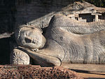
Upper part of a reclining Buddha. পলোন্নারুয়া জেলা, উত্তর-মধ্য প্রদেশ,  শ্রীলঙ্কা
৭°৫৪′৫৭″ উত্তর ৮১°০′২″ পূর্ব / ৭.৯১৫৮৩° উত্তর ৮১.০০০৫৬° পূর্ব / 7.91583; 81.00056 (Ancient City of Polonnaruwa)
সাংস্কৃতিক:
(ii), (iii), (vi)
১৯৮২ [৯]
সিগিরিয়া’র প্রাচীন নগর
(Ancient City of Sigiriya)
Foundations of buildings and in the distance a large rock several hundred metres high. মাতালে জেলা, মধ্য প্রদেশ,  শ্রীলঙ্কা
৭°৫৭′০″ উত্তর ৮০°৪৫′০″ পূর্ব / ৭.৯৫০০০° উত্তর ৮০.৭৫০০০° পূর্ব / 7.95000; 80.75000 (Ancient City of Sigiriya)
সাংস্কৃতিক:
(ii), (iii), (iv)
১৯৮২ [১০]
মহেঞ্জোদাড়োয় প্রত্নতাত্ত্বিক ধ্বংসাবশেষ
(Archaeological Ruins at Moenjodaro)
Archaeological site of white brick walls on a small hill. There is a circular structure at the top of the hill. সিন্ধ,  পাকিস্তান
২৭°১৯′৪৫″ উত্তর ৬৮°৮′২০″ পূর্ব / ২৭.৩২৯১৭° উত্তর ৬৮.১৩৮৮৯° পূর্ব / 27.32917; 68.13889 (Archaeological Ruins at Moenjodaro)
সাংস্কৃতিক:
(ii), (iii)
২৪০ (৫৯০) 1980 [১১]
সাঁচীর বৌদ্ধ স্মারকসমূহ
(Buddhist Monuments at Sanchi)
A heavily decorated gate in front of a stupa. রায়সেন, মধ্যপ্রদেশ,  ভারত
২৩°২৮′৪৬″ উত্তর ৭৭°৪৪′২৩″ পূর্ব / ২৩.৪৭৯৪৪° উত্তর ৭৭.৭৩৯৭২° পূর্ব / 23.47944; 77.73972 (Buddhist Monuments at Sanchi)
সাংস্কৃতিক:
(i), (ii), (iii), (iv), (vi)
১৯৮৯ [১২]
সর-ই-বাহলোলে প্রাচীন বৌদ্ধ আমলের ধ্বংসাবশেষ
(Buddhist Ruins of Takht-i-Bahi and Neighbouring City Remains at Sahr-i-Bahlol)
খাইবার পাখতুনখোয়া,  পাকিস্তান
৩৪°১৯′১৫″ উত্তর ৭১°৫৬′৪৫″ পূর্ব / ৩৪.৩২০৮৩° উত্তর ৭১.৯৪৫৮৩° পূর্ব / 34.32083; 71.94583 (Buddhist Ruins of Takht-i-Bahi and Neighbouring City Remains at Sahr-i-Bahlol)
সাংস্কৃতিক:
(iv)
১৯৮০ [১৩]
শ্রীলঙ্কার মধ্যবর্তী উচ্চভূমি
(Central Highlands of Sri Lanka)
Forested mountains, a settlement, a lake and a characteristic peak in the distance.  শ্রীলঙ্কা
৭°২৭′৯″ উত্তর ৮০°৪৮′৮″ পূর্ব / ৭.৪৫২৫০° উত্তর ৮০.৮০২২২° পূর্ব / 7.45250; 80.80222 (Central Highlands of Sri Lanka)
প্রাকৃতিক:
(ix), (x)
৫৬,৮৪৪ (১,৪০,৪৬০); buffer zone ৭২,৬৪৫ (১,৭৯,৫১০) ২০১০ [১৪]
চম্পানের-পাওয়াগড় প্রত্নক্ষেত্র
(Champaner-Pavagadh Archaeological Park)
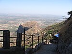
Pavagadh Hill পাঁচমহল জেলা, গুজরাত,  ভারত
২২°২৯′০″ উত্তর ৭৩°৩২′০″ পূর্ব / ২২.৪৮৩৩৩° উত্তর ৭৩.৫৩৩৩৩° পূর্ব / 22.48333; 73.53333 (Champaner-Pavagadh Archaeological Park)
সাংস্কৃতিক:
(iii), (iv), (v), (vi)
১,৩২৯ (৩,২৮০); buffer zone ২,৯১২ (৭,২০০) ২০০৪ [১৫]
ছত্রপতি শিবাজী ট্রামলাইন প্রান্ত (পূর্বনাম ভিক্টোরিয়া টার্মিনাস)
(Chhatrapati Shivaji Terminus (formerly Victoria Terminus))
Large building of reddish stone with columns, cupolas and turrets. The main cupola is topped by a human sculpture. মুম্বই, মহারাষ্ট্র,  ভারত
১৮°৫৬′২৪″ উত্তর ৭২°৫০′১০″ পূর্ব / ১৮.৯৪০০০° উত্তর ৭২.৮৩৬১১° পূর্ব / 18.94000; 72.83611 (Chhatrapati Shivaji Terminus (formerly Victoria Terminus))
সাংস্কৃতিক:
(ii), (iv)
২.৮৫ (৭.০) ২০০৪ [১৬]
চিতান জাতীয় উদ্যান
(Chitwan National Park)
A lake with tree trunks in the water. চিতান জেলা, নারায়ণী অঞ্চল,    নেপাল
২৭°৩০′০″ উত্তর ৮৪°২০′০″ পূর্ব / ২৭.৫০০০০° উত্তর ৮৪.৩৩৩৩৩° পূর্ব / 27.50000; 84.33333 (Chitwan National Park)
প্রাকৃতিক:
(vii), (ix), (x)
৯৩,২০০ (২,৩০,০০০) ১৯৮৪ [১৭]
গোয়ার গির্জা ও মঠ
(Churches and Convents of Goa)
A stone church.
গোয়া,  ভারত
১৫°৩০′৮″ উত্তর ৭৩°৫৪′৪২″ পূর্ব / ১৫.৫০২২২° উত্তর ৭৩.৯১১৬৭° পূর্ব / 15.50222; 73.91167 (Churches and Convents of Goa)
সাংস্কৃতিক:
(ii), (iv), (vi)
১৯৮৬ [১৮]
বামিয়ান উপত্যকায় সাংস্কৃতিক দৃশ্যমালা ও অবশিষ্ট প্রত্নতাত্ত্বিক নিদর্শন
(Cultural Landscape and Archaeological Remains of the Bamiyan Valley)
A large niche in a rock with the outline of a human figure.
বামিয়ান,  আফগানিস্তান
৩৪°৪৯′৫৫″ উত্তর ৬৭°৪৯′৩৬″ পূর্ব / ৩৪.৮৩১৯৪° উত্তর ৬৭.৮২৬৬৭° পূর্ব / 34.83194; 67.82667 (Cultural Landscape and Archaeological Remains of the Bamiyan Valley)
সাংস্কৃতিক:
(i), (ii), (iii), (iv), (vi)
১৫৯ (৩৯০) ২০০৩ [১৯]
[২০]
এলিফ্যান্টা গুহাসমূহ
(Elephanta Caves)
Sculpture of a three-headed figure.
এলিফ্যান্টা দ্বীপ, কোলাবা জেলা, মহারাষ্ট্র,  ভারত
১৮°৫৮′০″ উত্তর ৭২°৫৬′৯″ পূর্ব / ১৮.৯৬৬৬৭° উত্তর ৭২.৯৩৫৮৩° পূর্ব / 18.96667; 72.93583 (Elephanta Caves)
সাংস্কৃতিক:
(i), (iii)
১৯৮৭ [২১]
ইলোরা গুহাসমূহ
(Ellora Caves)
Heavily decorated religious structure cut from dark rock. বেরুল, আওরঙ্গবাদ জেলা, মহারাষ্ট্র,  ভারত
২০°১′৩৫″ উত্তর ৭৫°১০′৪৫″ পূর্ব / ২০.০২৬৩৯° উত্তর ৭৫.১৭৯১৭° পূর্ব / 20.02639; 75.17917 (Ellora Caves)
সাংস্কৃতিক:
(i), (iii), (vi)
১৯৮৩ [২২]
ফতেপুর সিকরি
(Fatehpur Sikri)
Square building of red stone with two floors crowned by small turrets at each corner. আগ্রা জেলা, উত্তরপ্রদেশ,  ভারত
২৭°৫′৪০″ উত্তর ৭৭°৩৯′৫১″ পূর্ব / ২৭.০৯৪৪৪° উত্তর ৭৭.৬৬৪১৭° পূর্ব / 27.09444; 77.66417 (Fatehpur Sikri)
সাংস্কৃতিক:
(ii), (iii), (iv)
১৯৮৬ [২৩]
লাহোরের শালমার বাগান
(Lahore Fort and Shalimar Gardens in Lahore)
Entrance gate to a fort flanked by two large towers. পাঞ্জাব,  পাকিস্তান
৩১°৩৫′২৫″ উত্তর ৭৪°১৮′৩৫″ পূর্ব / ৩১.৫৯০২৮° উত্তর ৭৪.৩০৯৭২° পূর্ব / 31.59028; 74.30972 (Fort and Shalamar Gardens in Lahore)
সাংস্কৃতিক:
(i), (ii), (iii)
১৯৮১ [২৪]
[২৫]
ডাম্বুলার স্বর্ণমন্দির
(Golden Temple of Dambulla)
Stupa and statues of bodhisattvas inside a cave. মাতালে জেলা, মধ্যপ্রদেশ,  শ্রীলঙ্কা
৭°৫১′২৪″ উত্তর ৮০°৩৮′৫৭″ পূর্ব / ৭.৮৫৬৬৭° উত্তর ৮০.৬৪৯১৭° পূর্ব / 7.85667; 80.64917 (Golden Temple of Dambulla)
সাংস্কৃতিক:
(i), (vi)
১৯৯১ [২৬]
গ্রেট হিমালয়ান জাতীয় উদ্যান
(Great Himalayan National Park)
The Great Himalayan National Park at dawn.
কুল্লু অঞ্চল, হিমাচল প্রদেশ, ভারত
৩১°৪৪′ উত্তর ৭৭°৩৩′ পূর্ব / ৩১.৭৩৩° উত্তর ৭৭.৫৫০° পূর্ব / 31.733; 77.550 (Great Himalayan National Park)
প্রাকৃতিক:
(x)
১,১৭,১০০ (২,৮৯,০০০) ২০১৪ [২৭]
মহান চোল মন্দিরসমূহ
(Great Living Chola Temples)
A sculpture of a human shaped figure in a niche.
টেমপ্লেট:দেশের উপাত্ত Iভারত
১০°৪৬′৫৯″ উত্তর ৭৯°৭′৫৭″ পূর্ব / ১০.৭৮৩০৬° উত্তর ৭৯.১৩২৫০° পূর্ব / 10.78306; 79.13250 (Great Living Chola Temples)
সাংস্কৃতিক:
(ii), (iii)
২২ (৫৪); buffer zone ১৭ (৪২) ১৯৮৭[nb ১] [২৮]
হাম্পির স্থাপনাসমূহ
(Group of Monuments at Hampi)
Ruins of a large decorated building.
বেলারি জেলা, কর্ণাটক,  ভারত
১৫°১৮′৫২″ উত্তর ৭৬°২৮′১৮″ পূর্ব / ১৫.৩১৪৪৪° উত্তর ৭৬.৪৭১৬৭° পূর্ব / 15.31444; 76.47167 (Group of Monuments at Hampi)
সাংস্কৃতিক:
(i), (iii), (iv)
১৯৮৬ [২৯]
মহাবলীপুরমের স্থাপনাসমূহ
(Group of Monuments at Mahabalipuram)
Ruins of a sandstone building with columns.
চিঙ্গলপুট জেলা, তামিলনাড়ু,  ভারত
১২°৩৭′০″ উত্তর ৮০°১১′৩০″ পূর্ব / ১২.৬১৬৬৭° উত্তর ৮০.১৯১৬৭° পূর্ব / 12.61667; 80.19167 (Group of Monuments at Mahabalipuram)
সাংস্কৃতিক:
(i), (ii), (iii), (vi)
১৯৮৪ [৩০]
পট্টডাকালের স্থাপনাসমূহ
(Group of Monuments at Pattadakal)
Stone structure decorated with columns, reliefs and sculptures and a high roof about the central part. বদমি, বিজাপুর জেলা, কর্ণাটক,  ভারত
১৫°৫৬′৫৪″ উত্তর ৭৫°৪৯′০″ পূর্ব / ১৫.৯৪৮৩৩° উত্তর ৭৫.৮১৬৬৭° পূর্ব / 15.94833; 75.81667 (Group of Monuments at Pattadakal)
সাংস্কৃতিক:
(iii), (iv)
৫.৫৬ (১৩.৭); buffer zone ১১৩ (২৮০) ১৯৮৭ [৩১]
রাজস্থানের পাহাড়ী দূর্গসমূহ
(Hill Forts of Rajasthan)
India, রাজস্থান,  ভারত
সাংস্কৃতিক:
(ii), (iii)
২০১৩ [৩২]
মাকলির ঐতিহাসিক স্থাপনাসমূহ
(Historical Monuments at Makli, Thatta)
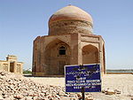
Ruins of an octagonal building crowned by a cupola. সিন্ধ,  পাকিস্তান
২৪°৪৬′০″ উত্তর ৬৭°৫৪′০″ পূর্ব / ২৪.৭৬৬৬৭° উত্তর ৬৭.৯০০০০° পূর্ব / 24.76667; 67.90000 (Historical Monuments at Makli, Thatta)
সাংস্কৃতিক:
(iii)
১৯৮১ [৩৩]
ঐতিহাসিক মসজিদের শহর বাগেরহাট
(Historic Mosque City of Bagerhat)
Building of red bricks with a roof consisting of many white domes. There are small round towers on the corners of the building each crowned by a white cupola.
বাগেরহাট জেলা, খুলনা বিভাগ,  বাংলাদেশ
২২°৪০′০″ উত্তর ৮৯°৪৮′০″ পূর্ব / ২২.৬৬৬৬৭° উত্তর ৮৯.৮০০০০° পূর্ব / 22.66667; 89.80000 (Historic Mosque City of Bagerhat)
সাংস্কৃতিক:
(iv)
১৯৮৫ [৩৪]
হুমায়ুনের সমাধিস্থল, দিল্লি
(Humayun's Tomb, Delhi)
Red and white stone building topped by a large white cupola and many small turrets. দিল্লি,  ভারত
২৮°৩৫′৩৬″ উত্তর ৭৭°১৫′২″ পূর্ব / ২৮.৫৯৩৩৩° উত্তর ৭৭.২৫০৫৬° পূর্ব / 28.59333; 77.25056 (Humayun's Tomb, Delhi)
সাংস্কৃতিক:
(ii), (iv)
১৯৯৩ [৩৫]
কাঠমান্ডু উপত্যকা
(Kathmandu Valley)
Streetscene with various characteristically shaped temple buildings. কাঠমান্ডু উপত্যকা,    নেপাল
২৭°৪২′১৪″ উত্তর ৮৫°১৮′৩১″ পূর্ব / ২৭.৭০৩৮৯° উত্তর ৮৫.৩০৮৬১° পূর্ব / 27.70389; 85.30861 (Kathmandu Valley)
সাংস্কৃতিক:
(iii), (iv), (vi)
১৬৭ (৪১০); buffer zone ৭০ (১৭০) ১৯৭৯[nb ২] The site has been listed as endangered 2003–2007 due to the partial or substantial loss of the traditional elements of six out of seven monument zones and resulting general loss of authenticity and integrity of the whole property. [৩৬]
কাজিরাঙা জাতীয় উদ্যান, অসম
(Kaziranga National Park)
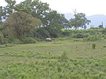
Grassland with a rhinoceros. অসম,  ভারত
২৬°৪০′ উত্তর ৯৩°২৫′ পূর্ব / ২৬.৬৬৭° উত্তর ৯৩.৪১৭° পূর্ব / 26.667; 93.417 (Kaziranga National Park)
প্রাকৃতিক:
(ix), (x)
৪২,৯৯৬ (১,০৬,২৫০) ১৯৮৫ [৩৭]
কেওলাদেও জাতীয় উদ্যান
(Keoladeo National Park)
Grassland under water with deer and a flying heron. রাজস্থান,  ভারত
২৭°৯′৩২″ উত্তর ৭৭°৩০′৩১″ পূর্ব / ২৭.১৫৮৮৯° উত্তর ৭৭.৫০৮৬১° পূর্ব / 27.15889; 77.50861 (Keoladeo National Park)
প্রাকৃতিক:
(x)
২,৮৭৩ (৭,১০০) ১৯৮৫ [৩৮]
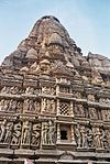
খাজুরাহোর স্থাপনাসমূহ (Khajuraho Group of Monuments)
Very tall stone structure decorated all over with sculptures.
মধ্যপ্রদেশ,  ভারত
২৪°৫১′৮″ উত্তর ৭৯°৫৫′২০″ পূর্ব / ২৪.৮৫২২২° উত্তর ৭৯.৯২২২২° পূর্ব / 24.85222; 79.92222 (Khajuraho Group of Monuments)
সাংস্কৃতিক:
(i), (iii)
১৯৮৬ [৩৯]
লুম্বিনি, মহাপ্রভু বুদ্ধের জন্মস্থান
(Lumbini, the Birthplace of the Lord Buddha)
A large tree next to a water filled pool. রূপংদেহী জেলা, লুম্বিনি অঞ্চল,    নেপাল
২৭°২৮′৮″ উত্তর ৮৩°১৬′৩৪″ পূর্ব / ২৭.৪৬৮৮৯° উত্তর ৮৩.২৭৬১১° পূর্ব / 27.46889; 83.27611 (Lumbini, the Birthplace of the Lord Buddha)
সাংস্কৃতিক:
(iii), (vi)
১.৯৫ (৪.৮); buffer zone ২৩ (৫৭) ১৯৯৭ [৪০]
বুদ্ধগয়ার মহাবোধি মন্দির চত্বর
(Mahabodhi Temple Complex at Bodh Gaya)
Very tall steep pyramid shaped stone building with reliefs all over the surfaces.
বিহার,  ভারত
২৪°৪১′৪৩″ উত্তর ৮৪°৫৯′৩৮″ পূর্ব / ২৪.৬৯৫২৮° উত্তর ৮৪.৯৯৩৮৯° পূর্ব / 24.69528; 84.99389 (Mahabodhi Temple Complex at Bodh Gaya)
সাংস্কৃতিক:
(i), (ii), (iii), (iv), (vi)
৪.৮৬ (১২.০) ২০০২ [৪১]
মানস জাতীয় উদ্যান
(Manas National Park)
Suspension bridge across a river in a forested mountain landscape.
অসম,  ভারত
২৬°৪৩′৩০″ উত্তর ৯১°১′৫০″ পূর্ব / ২৬.৭২৫০০° উত্তর ৯১.০৩০৫৬° পূর্ব / 26.72500; 91.03056 (Manas National Park)
প্রাকৃতিক:
(vii), (ix), (x)
৩৯,১০০ (৯৭,০০০) ১৯৮৫ [৪২]
জমের মিনার ও প্রত্নতাত্ত্বিক অবশিষ্টাংশ
(Minaret and Archaeological Remains of Jam)
A tall minaret in a river valley. At the top of the nearby mountains there are other, smaller structures. গড়,  আফগানিস্তান
৩৪°২৩′৪৮″ উত্তর ৬৪°৩০′৫৮″ পূর্ব / ৩৪.৩৯৬৬৭° উত্তর ৬৪.৫১৬১১° পূর্ব / 34.39667; 64.51611 (Minaret and Archaeological Remains of Jam)
সাংস্কৃতিক:
(ii), (iii), (iv)
৭০ (১৭০) ২০০২ [৪৩]
[৪৪]
ভারতের পার্বত্য রেলপথ
(Mountain Railways of India)
A small steam locomotive with three blue carriages.
 ভারত
১১°৩০′৩৭″ উত্তর ৭৬°৫৬′৯″ পূর্ব / ১১.৫১০২৮° উত্তর ৭৬.৯৩৫৮৩° পূর্ব / 11.51028; 76.93583 (Mountain Railways of India)
সাংস্কৃতিক:
(ii), (iv)
৮৯ (২২০); buffer zone ৬৪৫ (১,৫৯০) ১৯৯৯[nb ৩] [৪৫]
[৪৬]
[৪৭]
নন্দাদেবী ও ভ্যালি অফ ফ্লাওয়ার্স জাতীয় উদ্যান
(Nanda Devi National Park and Valley of Flowers National Parks)
Mountain valley full of pink flowers.
উত্তরাখণ্ড,  ভারত
৩০°৪৩′ উত্তর ৭৯°৪০′ পূর্ব / ৩০.৭১৭° উত্তর ৭৯.৬৬৭° পূর্ব / 30.717; 79.667 (Nanda Devi and Valley of Flowers National Parks)
প্রাকৃতিক:
(vii), (x)
৭১,৭৮৩ (১,৭৭,৩৮০); buffer zone ৫,১৪,২৮৬ (১২,৭০,৮৩০) ১৯৮৮[nb ৪] [৪৮]
গালের পুরনো শহর ও দূর্গনির্মাণ কৌশল
(Old Town of Galle and its Fortifications)
A white church and white lighthouse near the sea. গালে, দক্ষিণ প্রদেশ,  শ্রীলঙ্কা
৬°১′১৭″ উত্তর ৮০°১৩′৭″ পূর্ব / ৬.০২১৩৯° উত্তর ৮০.২১৮৬১° পূর্ব / 6.02139; 80.21861 (Old Town of Galle and its Fortifications)
সাংস্কৃতিক:
(iv)
১৯৮৮ [৪৯]
কুতুব মিনার ও স্থাপনাসমূহ
(Qutb Minar and its Monuments, Delhi)
Red and white building with a white dome and a tall tower or minaret with varying cross sections depending on height.
দিল্লি,  ভারত
২৮°৩১′৩৩″ উত্তর ৭৭°১১′৭″ পূর্ব / ২৮.৫২৫৮৩° উত্তর ৭৭.১৮৫২৮° পূর্ব / 28.52583; 77.18528 (Qutb Minar and its Monuments, Delhi)
সাংস্কৃতিক:
(iv)
১৯৯৩ [৫০]
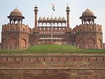
লাল কেল্লা কমপ্লেক্স
(Red Fort Complex)
Gate in a red wall crowned by various small cupolas and turrets. দিল্লি,  ভারত
২৮°৩৯′২০″ উত্তর ৭৭°১৪′২৭″ পূর্ব / ২৮.৬৫৫৫৬° উত্তর ৭৭.২৪০৮৩° পূর্ব / 28.65556; 77.24083 (Red Fort Complex)
সাংস্কৃতিক:
(ii), (iii), (vi)
৯৮ (২৪০); buffer zone ১০০ (২৫০) ২০০৭ [৫১]
ভীমবেটকা প্রস্তরক্ষেত্র
(Rock Shelters of Bhimbetka)
Red rock paintings of humans and humans on horses. মধ্যপ্রদেশ,  ভারত
২২°৫৫′৪০″ উত্তর ৭৭°৩৫′০″ পূর্ব / ২২.৯২৭৭৮° উত্তর ৭৭.৫৮৩৩৩° পূর্ব / 22.92778; 77.58333 (Rock Shelters of Bhimbetka)
সাংস্কৃতিক:
(iii), (v)
১,৮৯৩ (৪,৬৮০); buffer zone ১০,২৮০ (২৫,৪০০) ২০০৩ [৫২]
রোহতাসের কেল্লা
(Rohtas Fort)
Ruins of the gate to a fortress. ঝিলাম, পাঞ্জাব,  পাকিস্তান
৩২°৫৭′৪৫″ উত্তর ৭৩°৩৫′২০″ পূর্ব / ৩২.৯৬২৫০° উত্তর ৭৩.৫৮৮৮৯° পূর্ব / 32.96250; 73.58889 (Rohtas Fort)
সাংস্কৃতিক:
(ii), (iv)
১৯৯৭ [৫৩]
পাহাড়পুর বৌদ্ধবিহার
(Ruins of the Buddhist Vihara at Paharpur)
Ruins of a structure of red stone now resembling a small hill or mound.
নওগাঁ জেলা, রাজশাহী বিভাগ,  বাংলাদেশ
২৫°২′০″ উত্তর ৮৮°৫৯′০″ পূর্ব / ২৫.০৩৩৩৩° উত্তর ৮৮.৯৮৩৩৩° পূর্ব / 25.03333; 88.98333 (Ruins of the Buddhist Vihara at Paharpur)
সাংস্কৃতিক:
(i), (ii), (vi)
১৯৮৫ [৫৪]
অনুরাধাপুরার পবিত্র শহর
(Sacred City of Anuradhapura)
A large white stupa with an orange border near the bottom. অনুরাধাপুরা জেলা, উত্তর-মধ্য প্রদেশ,  শ্রীলঙ্কা
৮°২০′০″ উত্তর ৮০°২৩′০″ পূর্ব / ৮.৩৩৩৩৩° উত্তর ৮০.৩৮৩৩৩° পূর্ব / 8.33333; 80.38333 (Sacred City of Anuradhapura)
সাংস্কৃতিক:
(ii), (iii), (vi)
১৯৮২ [৫৫]
ক্যান্ডির পবিত্র শহর
(Sacred City of Kandy)
Administrative or religious building. মধ্যপ্রদেশ,  শ্রীলঙ্কা
৭°১৭′৩৭″ উত্তর ৮০°৩৮′২৫″ পূর্ব / ৭.২৯৩৬১° উত্তর ৮০.৬৪০২৮° পূর্ব / 7.29361; 80.64028 (Sacred City of Kandy)
সাংস্কৃতিক:
(iv), (vi)
১৯৮৮ [৫৬]
সাগরমাথা জাতীয় উদ্যান
(Sagarmatha National Park)
A village in a large mountain valley. In the distance very high snow-covered mountains are visible. সলুখাম্বু জেলা, সাগরমাথা অঞ্চল,    নেপাল
২৭°৫৭′৫৫″ উত্তর ৮৬°৫৪′৪৭″ পূর্ব / ২৭.৯৬৫২৮° উত্তর ৮৬.৯১৩০৬° পূর্ব / 27.96528; 86.91306 (Sagarmatha National Park)
প্রাকৃতিক:
(vii)
১,২৪,৪০০ (৩,০৭,০০০) ১৯৭৯ [৫৭]
সিংহরাজা বন সংরক্ষণ
(Sinharaja Forest Reserve)
Forested hilly landscape. সাবারাগামুয়াদক্ষিণ প্রদেশ,  শ্রীলঙ্কা
৬°২৫′ উত্তর ৮০°৩০′ পূর্ব / ৬.৪১৭° উত্তর ৮০.৫০০° পূর্ব / 6.417; 80.500 (Sinharaja Forest Reserve)
প্রাকৃতিক:
(ix), (x)
৮,৮৬৪ (২১,৯০০) ১৯৮৮ [৫৮]
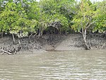
সুন্দরবন জাতীয় উদ্যান
(Sundarbans National Park)
Mangroves on a riverbank. পশ্চিমবঙ্গ,  ভারত
২১°৫৬′৪২″ উত্তর ৮৮°৫৩′৪৫″ পূর্ব / ২১.৯৪৫০০° উত্তর ৮৮.৮৯৫৮৩° পূর্ব / 21.94500; 88.89583 (Sundarbans National Park)
প্রাকৃতিক:
(ix), (x)
১,৩৩,০১০ (৩,২৮,৭০০) ১৯৮৭ [৫৯]
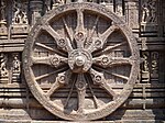
সূর্য মন্দির
(Sun Temple, Konârak)
Decorated wheel in stone relief. পুরি জেলা, উড়িষ্যা,  ভারত
১৯°৫৩′১৫″ উত্তর ৮৬°৫′৪১″ পূর্ব / ১৯.৮৮৭৫০° উত্তর ৮৬.০৯৪৭২° পূর্ব / 19.88750; 86.09472 (Sun Temple, Konârak)
সাংস্কৃতিক:
(i), (iii), (vi)
১১ (২৭) ১৯৮৪ [৬০]
তাজমহল
(Taj Mahal)
A white building with a big and several smaller cupolas framed by four white minarets at each corner. আগ্রা, উত্তরপ্রদেশ,  ভারত
২৭°১০′২৭″ উত্তর ৭৮°২′৩২″ পূর্ব / ২৭.১৭৪১৭° উত্তর ৭৮.০৪২২২° পূর্ব / 27.17417; 78.04222 (Taj Mahal)
সাংস্কৃতিক:
(i)
১৯৮৩ [৬১]
তক্ষিলা
(Taxila)
Ruins of stone buildings. পাঞ্জাব,  পাকিস্তান
৩৩°৪৬′৪৫″ উত্তর ৭২°৫৩′১৫″ পূর্ব / ৩৩.৭৭৯১৭° উত্তর ৭২.৮৮৭৫০° পূর্ব / 33.77917; 72.88750 (Taxila)
সাংস্কৃতিক:
(iii), (vi)
১৯৮০ [৬২]
যন্তর মন্তর, জয়পুর
(The Jantar Mantar, Jaipur)
A number of stone structures resembling giant sundials and other measurement instruments. জয়পুর, রাজস্থান,  ভারত
২৬°৫৫′২৯″ উত্তর ৭৫°৪৯′৩০″ পূর্ব / ২৬.৯২৪৭২° উত্তর ৭৫.৮২৫০০° পূর্ব / 26.92472; 75.82500 (The Jantar Mantar, Jaipur)
সাংস্কৃতিক:
(iii), (iv)
১.৮৭ (৪.৬); buffer zone ১৫ (৩৭) ২০১০ [৬৩]
সুন্দরবন
(The Sundarbans)
Boat on a river in a densely forested plain.
খুলনা বিভাগ,  বাংলাদেশ
২১°৫৭′০″ উত্তর ৮৯°১১′০″ পূর্ব / ২১.৯৫০০০° উত্তর ৮৯.১৮৩৩৩° পূর্ব / 21.95000; 89.18333 (The Sundarbans)
প্রাকৃতিক:
(ix), (x)
১,৩৯,৫০০ (৩,৪৫,০০০) ১৯৯৭ [৬৪]
পশ্চিম ঘাট পর্বতমালা
(Western Ghats)
Western Ghats at Matheran.
 ভারত প্রাকৃতিক:
(ix), (x)
১,৬০,০০,০০০ (৪,০০,০০,০০০) ২০১২ [৬৫]
রাণী কী ভব
(Rani ki vav)
Rani-ki-vav (the Queen's Stepwell) at Patan, Gujarat.
পতন, গুজরাত,  ভারত সাংস্কৃতিক:
(i)(iv)
4.68 ha ২০১৪ [৬৬]

তথ্যসূত্র[সম্পাদনা]

সাধারণ
টীকা
  1. "Number of World Heritage Properties by region"UNESCO। সংগ্রহের তারিখ ১০ সেপ্টেম্বর ২০১১ 
  2. "Composition of macro geographical (continental) regions, geographical sub-regions, and selected economic and other groupings"Geographical region and composition of each regionUnited Nations Statistics Division। ২০১০। সংগ্রহের তারিখ ২০ অক্টোবর ২০১১ 
  3. "World Heritage List"UNESCO। সংগ্রহের তারিখ ২৮ মে ২০১০  উদ্ধৃতি ত্রুটি: <ref> ট্যাগ বৈধ নয়; আলাদা বিষয়বস্তুর সঙ্গে "list" নামটি একাধিক বার সংজ্ঞায়িত করা হয়েছে
  4. "Number of World Heritage properties inscribed each Year"UNESCO। সংগ্রহের তারিখ ৮ সেপ্টেম্বর ২০১১ 
  5. "The Criteria for Selection"UNESCO। সংগ্রহের তারিখ ১০ সেপ্টেম্বর ২০১১ 
  6. "World Heritage in Danger"UNESCO। সংগ্রহের তারিখ ২৮ মে ২০১০ 
  7. "Agra Fort"UNESCO। সংগ্রহের তারিখ ২৮ মে ২০১০ 
  8. "Ajanta Caves"UNESCO। সংগ্রহের তারিখ ২৮ মে ২০১০ 
  9. "Ancient City of Polonnaruwa"UNESCO। সংগ্রহের তারিখ ২৮ মে ২০১০ 
  10. "Ancient City of Sigiriya"UNESCO। সংগ্রহের তারিখ ২৮ মে ২০১০ 
  11. "Archaeological Ruins at Moenjodaro"UNESCO। সংগ্রহের তারিখ ২৮ মে ২০১০ 
  12. "Buddhist Monuments at Sanchi"UNESCO। সংগ্রহের তারিখ ২৮ মে ২০১১ 
  13. "Buddhist Ruins of Takht-i-Bahi and Neighbouring City Remains at Sahr-i-Bahlol"UNESCO। সংগ্রহের তারিখ ২৮ মে ২০১০ 
  14. "Central Highlands of Sri Lanka"UNESCO। সংগ্রহের তারিখ ২৮ মে ২০১০ 
  15. "Champaner-Pavagadh Archaeological Park"UNESCO। সংগ্রহের তারিখ ২৮ মে ২০১০ 
  16. "Chhatrapati Shivaji Terminus (formerly Victoria Terminus)"UNESCO। সংগ্রহের তারিখ ২৮ মে ২০১০ 
  17. "Chitwan National Park"UNESCO। সংগ্রহের তারিখ ২৮ মে ২০১০ 
  18. "Churches and Convents of Goa"UNESCO। সংগ্রহের তারিখ ২৮ মে ২০১০ 
  19. "Cultural Landscape and Archaeological Remains of the Bamiyan Valley"UNESCO। সংগ্রহের তারিখ ২৮ মে ২০১০ 
  20. 27th session 2003, পৃ. 122–123
  21. "Elephanta Caves"UNESCO। সংগ্রহের তারিখ ২৮ মে ২০১০ 
  22. "Ellora Caves"UNESCO। সংগ্রহের তারিখ ২৮ মে ২০১০ 
  23. "Fatehpur Sikri"UNESCO। সংগ্রহের তারিখ ২৮ মে ২০১০ 
  24. "Fort and Shalamar Gardens in Lahore"। UNESCO 
  25. 24th session 2000, পৃ. 26
  26. "Golden Temple of Dambulla"UNESCO। সংগ্রহের তারিখ ২৮ মে ২০১০ 
  27. "Six new sites inscribed on World Heritage List"। UNESCO। সংগ্রহের তারিখ ২৩ জুন ২০১৪ 
  28. "Great Living Chola Temples"UNESCO। সংগ্রহের তারিখ ২৮ মে ২০১০ 
  29. "Group of Monuments at Hampi"UNESCO। সংগ্রহের তারিখ ২৮ মে ২০১০ 
  30. "Group of Monuments at Mahabalipuram"UNESCO। সংগ্রহের তারিখ ২৮ মে ২০১০ 
  31. "Group of Monuments at Pattadakal"UNESCO। সংগ্রহের তারিখ ২৮ মে ২০১১ 
  32. "Hill Forts of Rajasthan"UNESCO। সংগ্রহের তারিখ ২৫ জুন ২০১৩ 
  33. "Historical Monuments at Makli, Thatta"UNESCO। সংগ্রহের তারিখ ২৮ মে ২০১০ 
  34. "Historic Mosque City of Bagerhat"UNESCO। সংগ্রহের তারিখ ২৮ মে ২০১০ 
  35. "Humayun's Tomb, Delhi"UNESCO। সংগ্রহের তারিখ ২৮ মে ২০১০ 
  36. "Kathmandu Valley"UNESCO। সংগ্রহের তারিখ ২৮ মে ২০১০ 
  37. "Kaziranga National Park"UNESCO। সংগ্রহের তারিখ ২৮ মে ২০১০ 
  38. "Keoladeo National Park"UNESCO। সংগ্রহের তারিখ ২৮ মে ২০১০ 
  39. "Khajuraho Group of Monuments"UNESCO। সংগ্রহের তারিখ ২৮ মে ২০১০ 
  40. "Lumbini, the Birthplace of the Lord Buddha"UNESCO। সংগ্রহের তারিখ ২৮ মে ২০১০ 
  41. "Mahabodhi Temple Complex at Bodh Gaya"UNESCO। সংগ্রহের তারিখ ২৮ মে ২০১০ 
  42. "Manas National Park"UNESCO। সংগ্রহের তারিখ ২৮ মে ২০১০ 
  43. "Minaret and Archaeological Remains of Jam"UNESCO। সংগ্রহের তারিখ ২৮ মে ২০১০ 
  44. "World Heritage Committee: Twenty-sixth session" (PDF)UNESCO। পৃষ্ঠা 55। সংগ্রহের তারিখ ২৬ জুন ২০১১ 
  45. "Mountain Railways of India"UNESCO। সংগ্রহের তারিখ ২৮ মে ২০১০ 
  46. "Decision - 29COM 8B.31 - Extension of Properties Inscribed on World Heritage List (Mountain Railways of India)"UNESCO। সংগ্রহের তারিখ ২৮ মে ২০১০ 
  47. "Decision - 32COM 8B.28 - Examination of nomination of natural, mixed and cultural proprerties to the World Heritage List - Kalka Shimla Railway, Extension of Mountain Railways of India (INDIA)"UNESCO। সংগ্রহের তারিখ ২৮ মে ২০১০ 
  48. "Nanda Devi and Valley of Flowers National Parks"UNESCO। সংগ্রহের তারিখ ২৮ মে ২০১০ 
  49. "Old Town of Galle and its Fortifications"UNESCO। সংগ্রহের তারিখ ২৮ মে ২০১০ 
  50. "Qutb Minar and its Monuments, Delhi"UNESCO। সংগ্রহের তারিখ ২৮ মে ২০১০ 
  51. "Red Fort Complex"UNESCO। সংগ্রহের তারিখ ২৮ মে ২০১০ 
  52. "Rock Shelters of Bhimbetka"UNESCO। সংগ্রহের তারিখ ২৮ মে ২০১০ 
  53. "Rohtas Fort"UNESCO। সংগ্রহের তারিখ ২৮ মে ২০১০ 
  54. "Ruins of the Buddhist Vihara at Paharpur"UNESCO। সংগ্রহের তারিখ ২৮ মে ২০১০ 
  55. "Sacred City of Anuradhapura"UNESCO। সংগ্রহের তারিখ ২৮ মে ২০১০ 
  56. "Sacred City of Kandy"UNESCO। সংগ্রহের তারিখ ২৮ মে ২০১০ 
  57. "Sagarmatha National Park"UNESCO। সংগ্রহের তারিখ ২৮ মে ২০১০ 
  58. "Sinharaja Forest Reserve"UNESCO। সংগ্রহের তারিখ ২৮ মে ২০১০ 
  59. "Sundarbans National Park"UNESCO। সংগ্রহের তারিখ ২৮ মে ২০১০ 
  60. "Sun Temple, Konârak"UNESCO। সংগ্রহের তারিখ ২৮ মে ২০১০ 
  61. "Taj Mahal"UNESCO। সংগ্রহের তারিখ ২৮ মে ২০১০ 
  62. "Taxila"UNESCO। সংগ্রহের তারিখ ২৮ মে ২০১০ 
  63. "The Jantar Mantar, Jaipur"UNESCO। সংগ্রহের তারিখ ২৮ মে ২০১১ 
  64. "The Sundarbans"UNESCO। সংগ্রহের তারিখ ২৮ মে ২০১০ 
  65. "Western Ghats"। সংগ্রহের তারিখ ৩ জুলাই ২০১২ 
  66. http://whc.unesco.org/en/list/922

আরও দেখুন[সম্পাদনা]

পাদটীকা[সম্পাদনা]

  1. Extended in 2004 to include the Brihadisvara Temple Complex in Gangaikondacholapuram and the Airavatesvara Temple Complex in Darasuram and name change from Brihadisvara Temple, Thanjavur to the present name.
  2. Minor modification of boundaries in 2006.
  3. Extended in 2005 to include the Nilgiri Mountain Railway and in 2008 to include the Kalka–Shimla Railway. Name change in 2005 from Darjeeling Himalayan Railway to the present name.
  4. Extended in 2005???