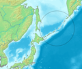
চিত্র:Kuril Islands.PNG

এই প্রাকদর্শনের আকার: ৭১৩ × ৬০০ পিক্সেল। অন্যান্য আকারসমূহ: ২৮৫ × ২৪০ পিক্সেল | ৫৭১ × ৪৮০ পিক্সেল | ১,০০০ × ৮৪১ পিক্সেল।
পূর্ণ রেজোলিউশন (১,০০০ × ৮৪১ পিক্সেল, ফাইলের আকার: ১.০৪ মেগাবাইট, এমআইএমই ধরন: image/png)
ফাইলের ইতিহাস
যেকোনো তারিখ/সময়ে ক্লিক করে দেখুন ফাইলটি তখন কী অবস্থায় ছিল।
| তারিখ/সময় | সংক্ষেপচিত্র | মাত্রা | ব্যবহারকারী | মন্তব্য | |
|---|---|---|---|---|---|
| বর্তমান | ১৮:১৬, ১৪ মে ২০২১ |  | ১,০০০ × ৮৪১ (১.০৪ মেগাবাইট) | Artanisen | Better quality version of the same image |
| ১৭:৫৬, ১৪ মে ২০২১ |  | ১,০০০ × ৮৪১ (৯৬৩ কিলোবাইট) | Artanisen | Higher quality version of the same image with transparent circle for the Kuril islands. | |
| ২০:১৪, ৯ আগস্ট ২০০৬ |  | ৫৮৬ × ৪৯৩ (১৭১ কিলোবাইট) | Michiel1972 | {{Information |Description=Kuril Islands |Source= own work based on PD map |Date= |Author= edited by M.Minderhoud |Permission= {{PD-Demis}} |other_versions= }} category:Locator maps of islands of Croatia |
সংযোগসমূহ
নিচের পৃষ্ঠা(গুলো) থেকে এই ছবিতে সংযোগ আছে:
ফাইলের বৈশ্বিক ব্যবহার
নিচের অন্যান্য উইকিগুলো এই ফাইলটি ব্যবহার করে:
- af.wikipedia.org-এ ব্যবহার
- de.wikipedia.org-এ ব্যবহার
- el.wikipedia.org-এ ব্যবহার
- es.wikipedia.org-এ ব্যবহার
- es.wikinews.org-এ ব্যবহার
- nl.wikipedia.org-এ ব্যবহার
- sr.wikipedia.org-এ ব্যবহার
