
চিত্র:Europe location ENG2.png

এই প্রাকদর্শনের আকার: ৮০০ × ৫৯৯ পিক্সেল। অন্যান্য আকারসমূহ: ৩২০ × ২৪০ পিক্সেল | ৬৪০ × ৪৭৯ পিক্সেল | ১,০২৪ × ৭৬৭ পিক্সেল | ১,২৮০ × ৯৫৯ পিক্সেল | ১,৫৯৪ × ১,১৯৪ পিক্সেল।
পূর্ণ রেজোলিউশন (১,৫৯৪ × ১,১৯৪ পিক্সেল, ফাইলের আকার: ৭২৮ কিলোবাইট, এমআইএমই ধরন: image/png)
| এই ফাইলটি উইকিমিডিয়া কমন্স থেকে নেওয়া। সেখানের বর্ণনা পাতার বিস্তারিত নিম্নে দেখানো হলো। (সম্পাদনা)
|
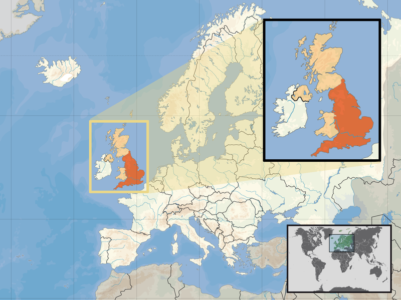
| বিবরণ | Location of England in the UK and Europe, on terrain map showing surface and underwater contour areas. | |||
| তারিখ | ||||
| উৎস | Derived from Wikimedia Commons image of original work forming part of the "Europe location" map series created by David Liuzzo: derived from Image:Europe_location_ENG.png. | |||
| লেখক | uploaded by User:Kmusser (excerpt from User:David_Liuzzo) | |||
| অনুমতি (এ ফাইলের পুনঃব্যবহার) |
|
|||
| অন্যান্য সংস্করণ |
|


ফাইলের ইতিহাস
যেকোনো তারিখ/সময়ে ক্লিক করে দেখুন ফাইলটি তখন কী অবস্থায় ছিল।
| তারিখ/সময় | সংক্ষেপচিত্র | মাত্রা | ব্যবহারকারী | মন্তব্য | |
|---|---|---|---|---|---|
| বর্তমান | ১৪:৫৮, ১৪ ফেব্রুয়ারি ২০১১ | | ১,৫৯৪ × ১,১৯৪ (৭২৮ কিলোবাইট) | Beao | Removed border. |
| ১৯:০০, ২৯ সেপ্টেম্বর ২০০৮ |  | ১,৬০০ × ১,২০০ (৭৯২ কিলোবাইট) | Kmusser | {{Information |Description= Location of England in the UK and Europe, on terrain map showing surface and underwater contour areas. |Source=Derived from Wikimedia Commons image of original work forming part of the "Europe location" map series c |
সংযোগসমূহ
নিচের পৃষ্ঠা(গুলো) থেকে এই ছবিতে সংযোগ আছে:
ফাইলের বৈশ্বিক ব্যবহার
নিচের অন্যান্য উইকিগুলো এই ফাইলটি ব্যবহার করে:
- ace.wikipedia.org-এ ব্যবহার
- ar.wikipedia.org-এ ব্যবহার
- az.wiktionary.org-এ ব্যবহার
- br.wikipedia.org-এ ব্যবহার
- cs.wikipedia.org-এ ব্যবহার
- da.wikipedia.org-এ ব্যবহার
- dsb.wikipedia.org-এ ব্যবহার
- dty.wikipedia.org-এ ব্যবহার
- en.wikipedia.org-এ ব্যবহার
- es.wikipedia.org-এ ব্যবহার
- eu.wiktionary.org-এ ব্যবহার
- ext.wikipedia.org-এ ব্যবহার
- fiu-vro.wikipedia.org-এ ব্যবহার
- hr.wikiquote.org-এ ব্যবহার
- incubator.wikimedia.org-এ ব্যবহার
- ja.wiktionary.org-এ ব্যবহার
- ka.wikipedia.org-এ ব্যবহার
- my.wikipedia.org-এ ব্যবহার
- nds-nl.wikipedia.org-এ ব্যবহার
- nl.wikibooks.org-এ ব্যবহার
- pam.wikipedia.org-এ ব্যবহার
- pl.wikipedia.org-এ ব্যবহার
- pl.wiktionary.org-এ ব্যবহার
- pnb.wikipedia.org-এ ব্যবহার
- pt.wiktionary.org-এ ব্যবহার
- sc.wikipedia.org-এ ব্যবহার
- shn.wikipedia.org-এ ব্যবহার
- simple.wikipedia.org-এ ব্যবহার
- sr.wikipedia.org-এ ব্যবহার
- sv.wikivoyage.org-এ ব্যবহার
- vls.wikipedia.org-এ ব্যবহার
- xmf.wikipedia.org-এ ব্যবহার
- yo.wikipedia.org-এ ব্যবহার
- zh.wikinews.org-এ ব্যবহার