
চিত্র:Estonian archipelago (Saaremaa and Hiiumaa).jpg
Estonian_archipelago_(Saaremaa_and_Hiiumaa).jpg (৩৫৪ × ৫১৬ পিক্সেল, ফাইলের আকার: ৩৩ কিলোবাইট, এমআইএমই ধরন: image/jpeg)
| এই ফাইলটি উইকিমিডিয়া কমন্স থেকে নেওয়া। সেখানের বর্ণনা পাতার বিস্তারিত নিম্নে দেখানো হলো। (সম্পাদনা)
|
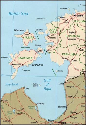
Estonian achipelo (Saarema and Hiiumaa) from en:wiki
This image is an edited version of the original image from the Perry-Castañeda Library Map Collection ([1]) at the University of Texas Libraries. Editing and original upload by en:user:Pascal on en:wiki
See http://www.lib.utexas.edu/maps/europe/estonia_pol99.jpg
The Frequently Asked Questions section indicates that unless otherwise indicated, maps are in the public domain. No such indication for this image.

|
This map image could be re-created using vector graphics as an SVG file. This has several advantages; see Commons:Media for cleanup for more information. If an SVG form of this image is available, please upload it and afterwards replace this template with
{{vector version available|new image name}}.
It is recommended to name the SVG file “Estonian archipelago (Saaremaa and Hiiumaa).svg”—then the template Vector version available (or Vva) does not need the new image name parameter. |


| এই কাজের প্রণেতা Perry-Castañeda Library কাজটি পাবলিক ডোমেইনে প্রকাশ করেছেন। এটি বিশ্বব্যাপী প্রযোজ্য হবে। কিছু দেশে এটি আইনত সিদ্ধ নাও হতে পারে, যদি তাই হয়: Perry-Castañeda Library যে-কাউকে যেকোনো উদ্দেশ্যে, বিনাশর্তে এই কাজটি ব্যবহারের অনুমতি প্রদান করেন, যদি না সেই শর্তগুলো আইনত প্রয়োজনীয় হয়।
|
_(cropped_230x260).jpg)
.jpg?uselang=bn)
.jpg&action=edit)
ফাইলের ইতিহাস
যেকোনো তারিখ/সময়ে ক্লিক করে দেখুন ফাইলটি তখন কী অবস্থায় ছিল।
| তারিখ/সময় | সংক্ষেপচিত্র | মাত্রা | ব্যবহারকারী | মন্তব্য | |
|---|---|---|---|---|---|
| বর্তমান | ১৮:৫৫, ১৮ এপ্রিল ২০০৭ | | ৩৫৪ × ৫১৬ (৩৩ কিলোবাইট) | Tene~commonswiki | Reverted to earlier revision |
| ১৮:৫২, ১৮ এপ্রিল ২০০৭ |  | ৩৫৪ × ৫১৬ (৩৩ কিলোবাইট) | Tene~commonswiki | {{Information |Description=Map Of Estonian archipelago (Saaremaa and Hiiumaa) from http://www.lib.utexas.edu/maps/europe/estonia_pol99.jpg See talk page for copyright explanation. Quote... "Most of the maps scanned by the University of Texas Libraries | |
| ১৯:০৫, ২০ মার্চ ২০০৫ |  | ৩৫৪ × ৫১৬ (৩৩ কিলোবাইট) | Laurens~commonswiki | Estonian achipelo (Saarema and Hiiumaa) from en:wiki |
সংযোগসমূহ
নিচের পৃষ্ঠা(গুলো) থেকে এই ছবিতে সংযোগ আছে:
ফাইলের বৈশ্বিক ব্যবহার
নিচের অন্যান্য উইকিগুলো এই ফাইলটি ব্যবহার করে:
- af.wikipedia.org-এ ব্যবহার
- ar.wikipedia.org-এ ব্যবহার
- arz.wikipedia.org-এ ব্যবহার
- avk.wikipedia.org-এ ব্যবহার
- az.wikipedia.org-এ ব্যবহার
- az.wiktionary.org-এ ব্যবহার
- be-tarask.wikipedia.org-এ ব্যবহার
- bg.wikipedia.org-এ ব্যবহার
- br.wikipedia.org-এ ব্যবহার
- ca.wikipedia.org-এ ব্যবহার
- ceb.wikipedia.org-এ ব্যবহার
- cs.wikipedia.org-এ ব্যবহার
- cy.wikipedia.org-এ ব্যবহার
- da.wikipedia.org-এ ব্যবহার
- de.wikipedia.org-এ ব্যবহার
- dsb.wikipedia.org-এ ব্যবহার
- el.wikipedia.org-এ ব্যবহার
- en.wikipedia.org-এ ব্যবহার
- en.wikivoyage.org-এ ব্যবহার
- eo.wikipedia.org-এ ব্যবহার
- es.wikipedia.org-এ ব্যবহার
এই ফাইলের অন্যান্য বৈশ্বিক ব্যবহার দেখুন।
.jpg)
.jpg)